Coldest air of the season arrives for the start of meteorological winter
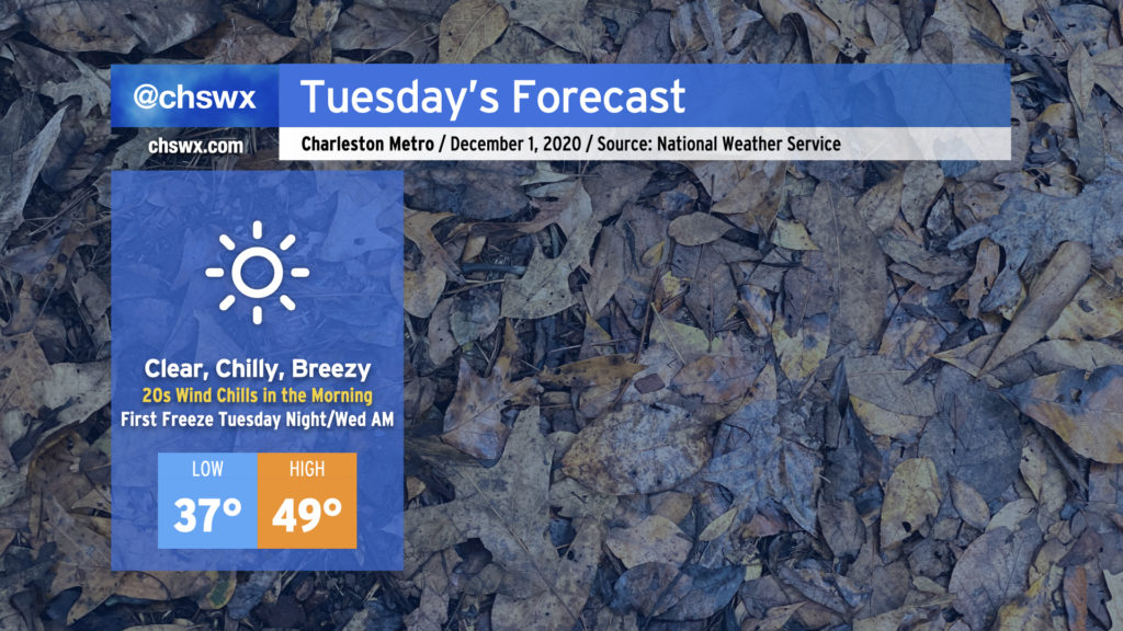
We in the weather community have been talking about this cold snap for a while, and it is finally here. Tuesday promises to be a very chilly day — the coolest since mid-February — with highs struggling to reach 50° despite full sunshine. A persistent westerly wind will keep temperatures feeling even colder, too, with wind chills in the upper 20s expected in the morning. Make sure your loved ones, two and four-legged, have a warm place to be tonight (and for the next couple nights).
Meteorological winter begins
December 1 marks the beginning of meteorological winter. Climatologists and meteorologists use December 1-February 28 (or 29 in leap years) as the winter period because it is easy to compare year-over-year.
December 1 also marks the climatological end to the growing season in southeast South Carolina. This means that the National Weather Service will not be issuing frost and freeze advisories until the growing season resumes on March 1.
Of course, something else comes to an end when the calendar strikes December, too…
Hurricane season ends…
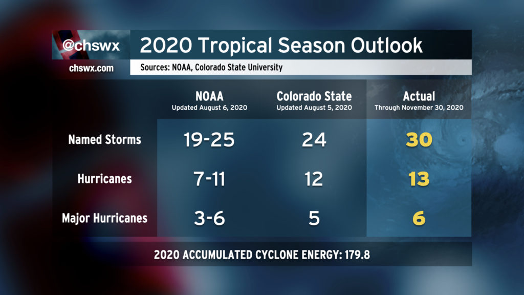
November 30 marks the end of the climatological Atlantic hurricane season. And what a season it was — 30 named storms, 13 hurricanes, and 6 major hurricanes. We blew through the original list of storm names by September and made it all the way to Iota in the Greek alphabet, which breaks 2005’s record of 29 named storms.
Once again, the Lowcountry came away incredibly lucky. After the freaky spin-up and landfall of Bertha at Dewees Island in May, Isaias was our only other major tropical concern this year, and it was relatively tame for us as tropical systems go.
2020 marks the first hurricane season since 2014 without some sort of evacuation order due to a landfalling tropical system. It was helpful not to have to combine an evacuation and a pandemic, and we were very fortunate to not have to deal with that situation unlike our neighbors to the north in North Carolina and our friends on the Gulf Coast, especially in Louisiana, which just got hammered this year.
As always, thanks to everyone who took the season seriously and stayed prepared throughout. Our recent brushes over the last few years are a stark reminder that we are vulnerable to hurricanes here in the Lowcountry — and perhaps more than ever given sea level rise and the increased prevalence and severity of coastal flooding.
…but it might not be totally done yet
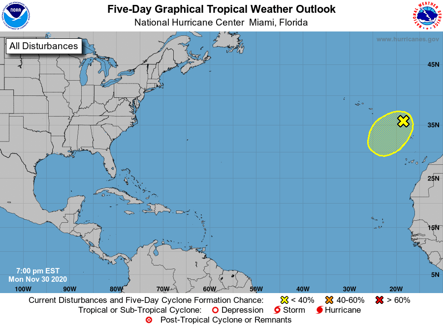
The thing about weather is that it could care less about our silly calendars. Just because November 30 is the climatological end of the season doesn’t mean we can’t have any storms after that date. Sure enough, the Hurricane Center — weary as its forecasters must be — has eyes on a low pressure system way out there in the eastern Atlantic for possible subtropical development. If in fact it gets going, it would be named Kappa. This feature will not pose a threat to the United States.
Stay warm, everyone.
Follow my Charleston Weather updates on Mastodon, Bluesky, Instagram, Facebook, or directly in a feed reader. Do you like what you see here? Please consider supporting my independent, hype-averse weather journalism and become a supporter on Patreon for a broader look at all things #chswx!