After another freeze, warming begins on Thursday
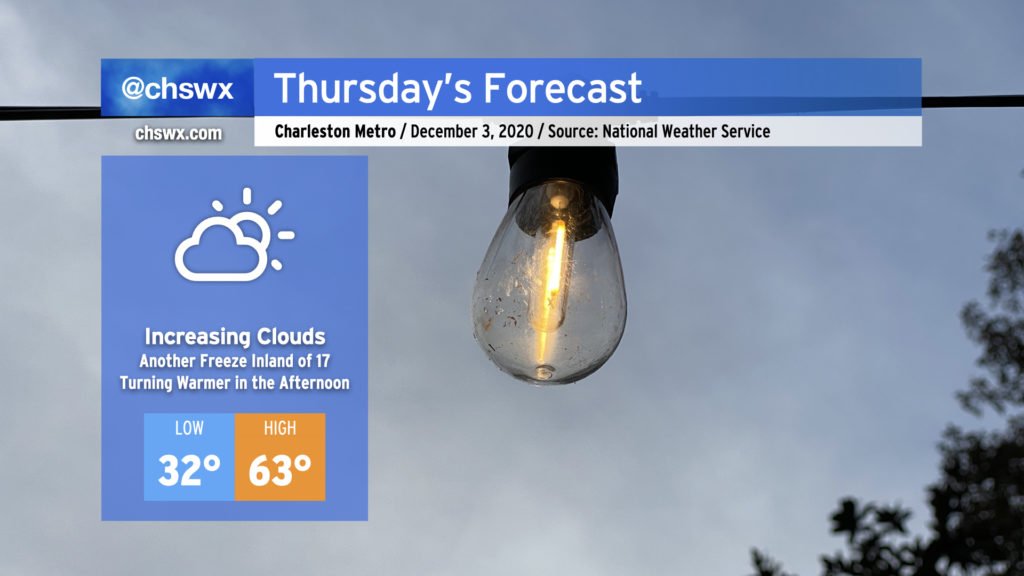
Bring in your pets and plants again tonight as temperatures will be headed toward the freezing mark once more, generally along and inland of Highway 17. The freeze won’t be quite as widespread as we saw this morning, but expect temperatures to fall into the 30s close to the coast, including into downtown Charleston.
After the chilly start, temperatures will rebound back into the 60s for the afternoon as winds turn more onshore throughout the day. Expect clouds to increase as well from the west ahead of our next storm system, which brings rain back to the area for Friday.
Friday & the weekend: Rain gives way to continued below-normal temperatures
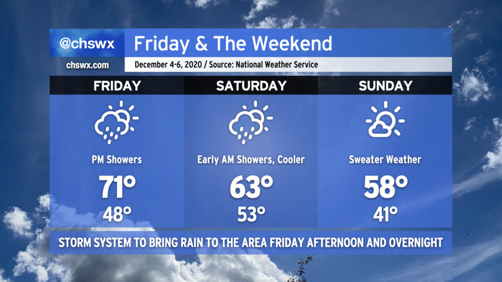
As we get into Friday, temperatures will warm back into the 70s, and we’ll see rain chances begin to head up in the afternoon. Two rounds of rain appear to be possible. The first round will be generally scattered downpours coming in off the ocean. The second round will be associated with a cold front and come through generally late in the evening into overnight. Expect the heaviest rain overnight Friday. Thunder looks pretty unlikely given a dearth of instability.
Rain will be out of the area by early Saturday morning, and clouds will scour out in the wake of the front. We’ll begin to turn cooler, with highs topping out in the low 60s by Saturday afternoon. A few clouds hang around for Sunday, with a nice day to don a sweater as highs stay generally in the upper 50s.
Follow my Charleston Weather updates on Mastodon, Bluesky, Instagram, Facebook, or directly in a feed reader. Do you like what you see here? Please consider supporting my independent, hype-averse weather journalism and become a supporter on Patreon for a broader look at all things #chswx!