Windy, stormy Christmas Eve ahead
Details are coming into focus around what will be quite a strong storm for the Eastern Seaboard for Christmas Eve. Model guidance is in unanimous agreement for a strong band of showers and thunderstorms ahead of the cold front that could produce occasional damaging wind gusts during the afternoon and early evening hours. The good news is that this activity should get out of here by the time Santa is ready to make his rounds in the Lowcountry.
What to expect
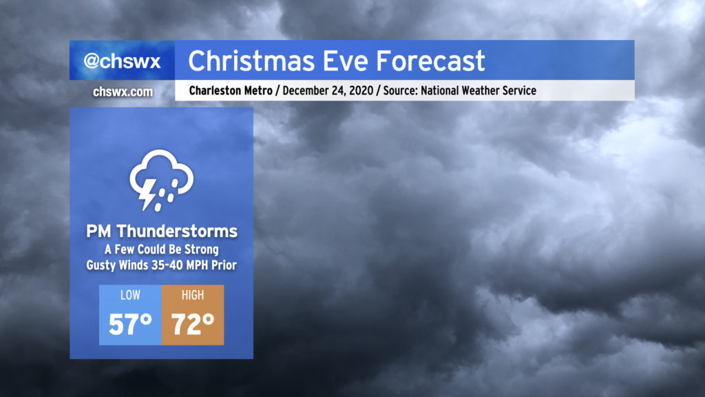
Across the Lowcountry, expect scattered showers to begin the day. More notable, though, will be the winds. We’ll start the day with southerly gusts to around 20-25 MPH. As the low-level jet intensifies and moves overhead, though, expect sustained winds to kick up to around 20 MPH with gusts 35-40 MPH even well ahead of thunderstorms. This could blow around Christmas decorations, so consider bringing in the loose decorations so that they don’t come loose and head down the street. Winds will be a little gustier right along the coast, too. A Small Craft Advisory is in effect for Charleston Harbor, while the nearshore waters are under a Gale Warning.
Temperatures will be quite mild compared to recent days, with highs topping out in the low 70s ahead of the rain and the cold front. Savor it — it’s gonna get downright cold on Christmas. (More on that in a sec.)
The pre-frontal line of thunderstorms should begin to approach the area in the late afternoon hours based on current model timings. These could be a bit on the strong side, so let’s talk about that.
Severe weather outlook
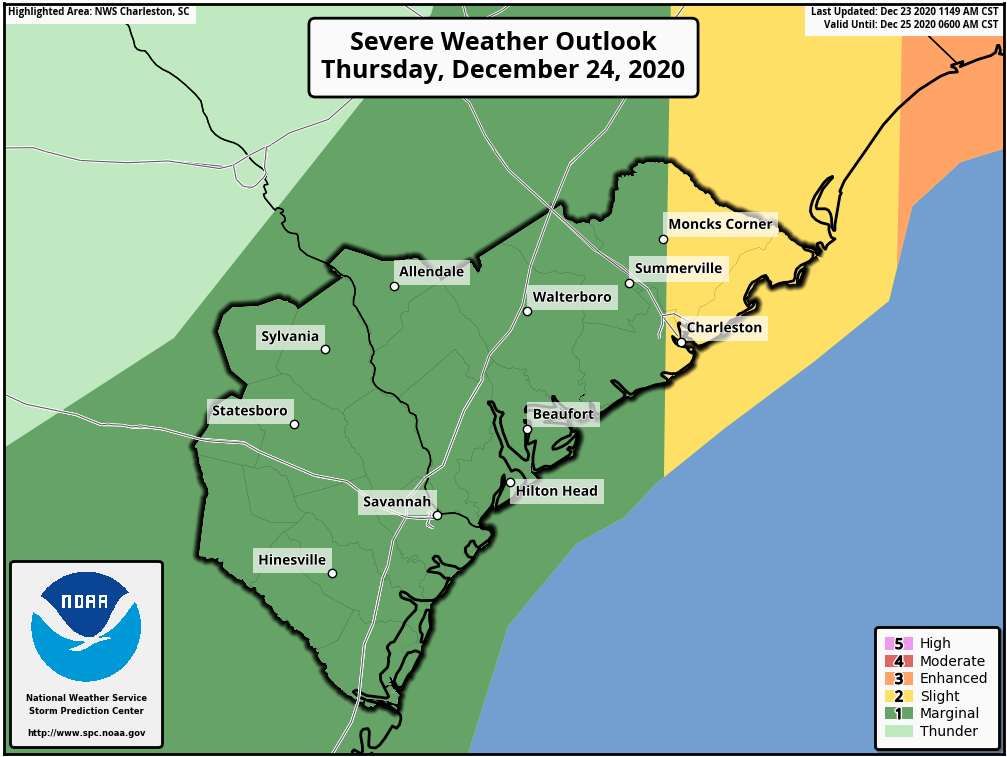
There will be a risk for severe weather across the Lowcountry on Thursday. The primary concern will be damaging winds, but a tornado or two cannot be ruled out along the line. The greatest risk of severe weather will be found generally east of Highway 52, with an enhanced risk for supercells and tornadoes further to our northeast along the Grand Strand and into eastern North Carolina.
The window for severe storms looks to open around 3PM near I-95 to 8PM at the coast. A lot depends on how much instability can develop ahead of the line, with the most instability likely developing near the coast. Still, the instability looks fairly weak. Additionally, cooler shelf waters certainly could act as a damper to the line as it moves to the coast, but the plentiful upper-air energy and wind shear should at least partially offset this and keep storms vigorous as they move to the coast.
Storms look to come to an end around midnight, with much, much cooler air to follow.
A lump of cold under the Christmas tree
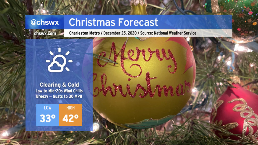
Christmas is looking very, very chilly. Cloud cover will scour out, and very strong cold advection from an Arctic-sourced airmass will overcome the sunshine and limit highs to just the low 40s at best. Winds gusting 20-30 MPH will keep wind chills pinned in the mid-20s even at the height of the afternoon. If you’re headed out, layer up — this is easily the coldest air of the season, just in time to close the year.
Be ready for a hard freeze overnight Friday into Saturday morning, with lows dipping into the mid-20s. Temperatures will slowly moderate over the weekend, but will remain well below normal.
Follow my Charleston Weather updates on Mastodon, Bluesky, Instagram, Facebook, or directly in a feed reader. Do you like what you see here? Please consider supporting my independent, hype-averse weather journalism and become a supporter on Patreon for a broader look at all things #chswx!