Hard freeze tonight, chilly weekend ahead
Get ready for a hard freeze tonight as temperatures plummet into the low-to-mid-20s pretty much everywhere inland of the immediate coast, where temperatures will still likely reach freezing. While winds will die down a little, there will still be enough to send wind chills into the upper teens for Saturday morning. Protect plants, pets, pipes, and people tonight.
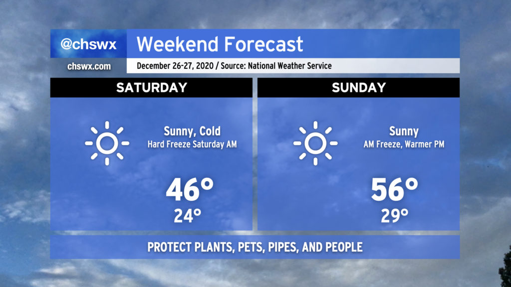
Saturday will be another day where temperatures struggle into the mid-40s despite full sunshine. After another freeze Sunday morning, temperatures will begin to moderate, topping out in the mid-50s in the afternoon with plenty of sunshine to continue.
A rare Christmas snow at the airport
A little moisture on the back side of last night’s storm system was just enough to squeeze out a few small flurries from Walterboro to Cottageville to the airport before it dissipated. The National Weather Service office at Charleston International Airport bore witness to these flurries, and light snow was recorded at the airport.
It remains to be seen how it is entered into the climate database, but if a trace of snow is indeed logged for today, it would be only the second time snowfall was observed on Christmas Day since records began at the North Charleston climate site in 1938. The only other instance was a trace of snow on Christmas Day 1998.
Of course, Christmas 1989 reigns supreme as the only white Christmas on record in Charleston, with 4″ of snow on the ground from the December 22-24 winter storm.
Follow my Charleston Weather updates on Mastodon, Bluesky, Instagram, Facebook, or directly in a feed reader. Do you like what you see here? Please consider supporting my independent, hype-averse weather journalism and become a supporter on Patreon for a broader look at all things #chswx!