Rest of the week: 2020 offers a stormy transition to 2021
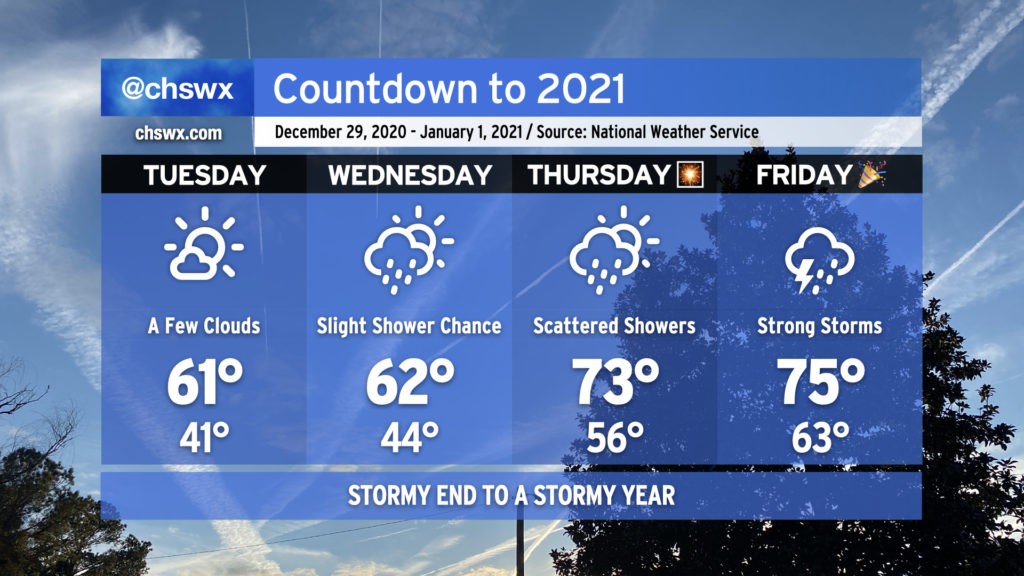
2020 looks to hand off to 2021 in the fashion we would expect from this year — a bit on the warm and stormy side — as a cold front approaches the area from the west.
The last few days of the year will get progressively warmer, with 70s back in the picture for New Year’s Eve. Rain chances also return beginning Wednesday, with a shower or two possible as a coastal trough moves inland in response to high pressure to the northeast breaking down and moving out. Rain chances improve for Thursday along with a noticeable jump in temperatures (70s!) as warm and moist air overspreads the area ahead of our next storm system.
Overall, if you’ve got things to do outdoors, Tuesday’s your best day to for-sure avoid rainfall. As for New Year’s Eve, I’m not expecting a washout for fireworks displays as of now, but the devil is in the details. Stay tuned.
Strong storms possible for New Year’s Day
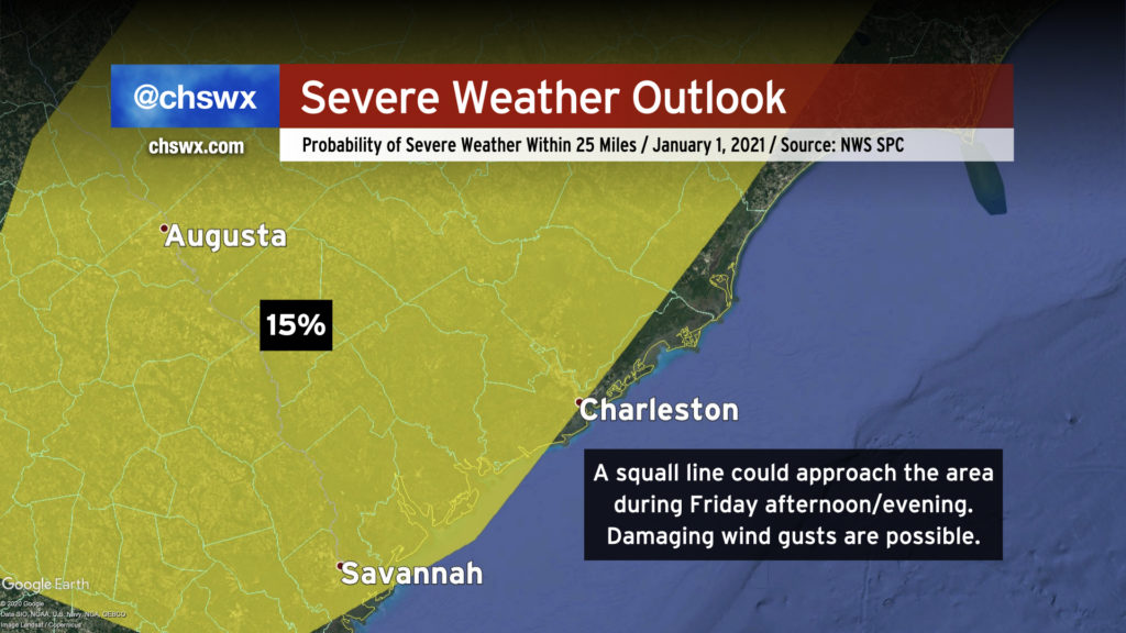
Models are in pretty good agreement that a squall line will develop and head eastward across the Southeast during New Year’s Day. This line could produce sporadic damaging wind gusts and possibly a tornado or two as it approaches the Lowcountry on Friday. In a rare move for late December/early January, the Storm Prediction Center has already outlined much of the area in a slight risk/15% probability for severe weather in anticipation of this system.
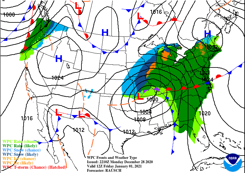
A glance at the forecast surface map for 7am Friday shows the Lowcountry in the warm sector of a deepening low pressure system that will move northeast into the Great Lakes region throughout the day. A squall line is forecast to be going ahead of the front at this time, driven by respectable amounts of wind shear aloft with a little instability available to bring severe gusts to the surface as it moves across Georgia and western SC.
The severe risk gets a little iffier as the line gets closer to the coast as instability, already a big question mark, becomes more questionable. Additionally, at least right now it looks like the line is going to outrun the best dynamics, which will remain to the west of the area as low pressure aloft and at the surface ejects across the Ohio Valley.
Bottom line: There are a lot of details to work out with this system, with fine-tuning needed as one would expect four to five days out. Keep an eye on the forecast for updates.
Follow my Charleston Weather updates on Mastodon, Bluesky, Instagram, Facebook, or directly in a feed reader. Do you like what you see here? Please consider supporting my independent, hype-averse weather journalism and become a supporter on Patreon for a broader look at all things #chswx!