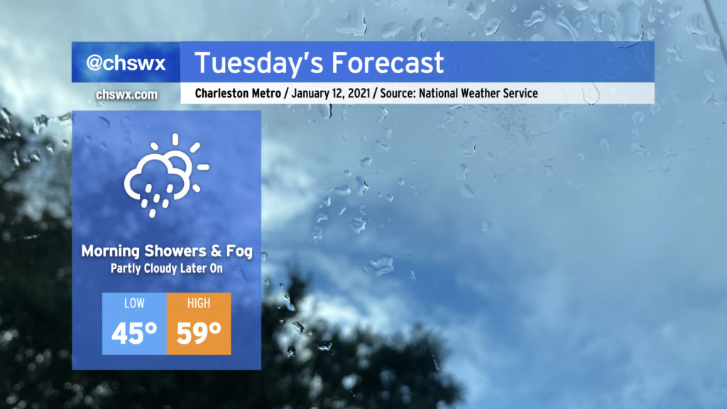
Rain overnight gives way to a little bit of afternoon sun Tuesday

As low pressure moves eastward along the Gulf coast, we’ll keep the risk of showers and drizzle around through early Tuesday afternoon before high pressure begins to build in and cloud cover slowly breaks. Watch for areas of fog in the morning; be sure to use low beams and be prepared for visibility to drop quickly.
We should see a little sun before Tuesday’s gone, and there will be much more where that comes from as we get into the rest of the week. Temperatures could top out in the upper 50s, but this certainly will be dependent on how quickly the cloud deck can scour out.
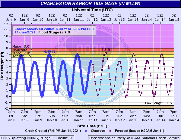
Coastal flooding risk continues Tuesday morning

Minor coastal flooding will be possible once again around the 7:10 AM high tide. The upcoming new moon and continued northeasterly winds will drive tide levels to around 7.2-7.4′. Coastal flooding will be possible two hours either side of high tide, so be ready for possible road closures particularly around the Citadel.
In memoriam
I am saddened to report the untimely passing of Patrick L. Archibald, a stalwart in the Charleston technology and maker scene. If you’ve been following @chswx or the #chswx hashtag on Twitter for a while, you have undoubtedly seen some of the scenes he captured while biking around Berkeley County, especially around storm season. He was a big supporter of this site (and of the independent creator community writ large), and was always so curious about and interested in the finer points of weather prediction and remote sensing. He will be missed greatly by his family and friends, and I extend my condolences to them as they grieve.
Follow my Charleston Weather updates on Mastodon, Bluesky, Instagram, Facebook, or directly in a feed reader. Do you like what you see here? Please consider supporting my independent, hype-averse weather journalism and become a supporter on Patreon for a broader look at all things #chswx!