Cold front brings storms for Wednesday and chilly weather thereafter
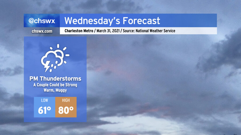
A cold front will approach the area from the west throughout the day Wednesday, with shower and thunderstorm chances increasing later in the day as the front gets closer. A couple showers or storms can’t be ruled out in the afternoon well ahead of it, but the best rain chances will start early in the evening through the overnight. One or two storms could turn strong with gusty winds and hail, especially for those of you who are further inland. However, widespread severe weather is not expected.
We’ll be at the apex of this week’s temperature rollercoaster with highs topping out around 80° in the afternoon. Afterward, it’s a much different story…
Turning much cooler on Thursday
This is going to be quite a sharp front. Here’s the High Resolution Rapid Refresh output valid tonight through Thursday evening.
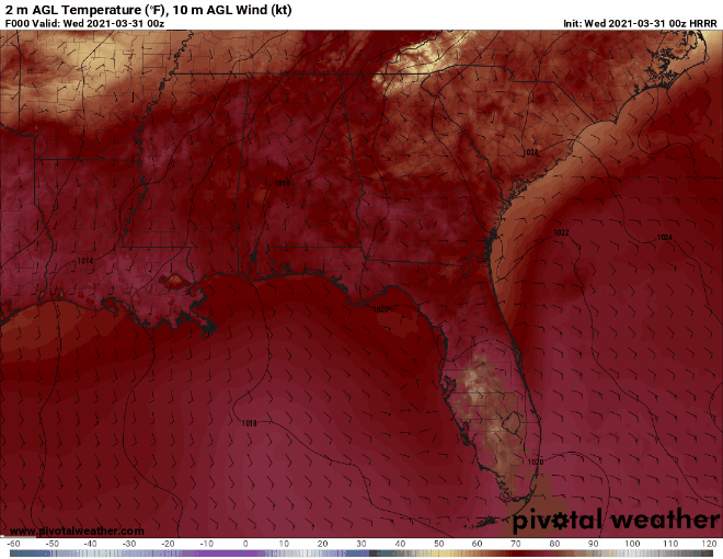
Now, I’m not normally a “raw model output on the blog” kind of guy, but this does a good job of demonstrating just how sharp the temperature drop will be post-frontal passage. Expect the front to clear the area early Thursday morning — by sunrise, it’ll feel at least 10° cooler than at the same time Wednesday morning.
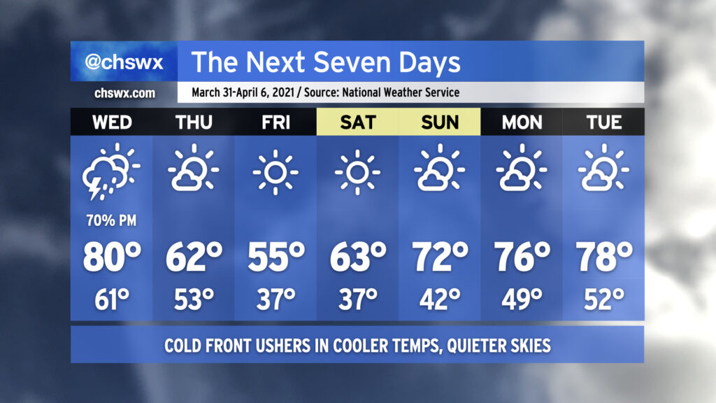
Beyond Thursday, we will need to be aware of the potential for frost Friday and Saturday mornings, with even the risk of a late-season freeze well inland, so be ready to protect plants and pets. Highs will bottom out in the mid-50s on Friday as the core of the cool airmass works into the area. The early April sun angle, though, will gradually modify that airmass as we get into the weekend and beyond, with temperatures approaching the upper 70s once again by the middle of next week. Rain chances are minimal beyond Wednesday, too, giving us a little time to dry out and ample opportunity to enjoy a nice stretch of weather.
We’re getting into a point of the year where the opportunities for sweater weather become more and more rare. If sweater weather is your thing, savor this, because it might not be back for a while as above-normal temperatures are favored throughout April.
Follow my Charleston Weather updates on Mastodon, Bluesky, Instagram, Facebook, or directly in a feed reader. Do you like what you see here? Please consider supporting my independent, hype-averse weather journalism and become a supporter on Patreon for a broader look at all things #chswx!