Friday and the weekend: Brrr
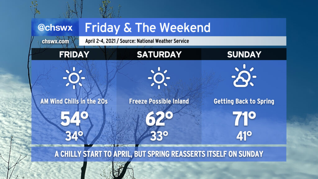
Get ready for what is probably Winter’s final hurrah starting tonight into this weekend. Overnight tonight, temperatures look to fall to the mid-30s in the Charleston Metro Area, with the potential for those temperatures to fall even a bit more inland. I’d protect plants and pets tonight to be on the safe side. Wind chills tomorrow morning will run as low as the mid-20s at times — bone-chilling for January, somewhat absurd for April. In addition to possibly setting a record low in the morning (the record is 36° set in 1942), Friday’s forecast high of 54° would break the record low maximum temperature of 56° set in 2019. All this and we will have full, unfettered sunshine throughout the day. Quite a potently cold airmass, for sure.
The chill continues into Saturday morning. Winds look to back off a little bit, but that may just allow for better radiational cooling conditions with the potential for a freeze inland from the coast and patchy frost elsewhere. Friday night into Saturday morning will be another time to protect your plants and pets from the chilly conditions. Saturday afternoon does look a little warmer with highs getting into the low 60s, but this is still well below normal for early April.
By Sunday, though, we begin to lift out of the cold snap with lows in the low 40s in the morning, followed by highs getting back into the 70s in the afternoon. Just a few clouds will be around, and it looks to be a rather pleasant day.
Bundle up and enjoy the weekend!