After a raucous evening, we turn much cooler
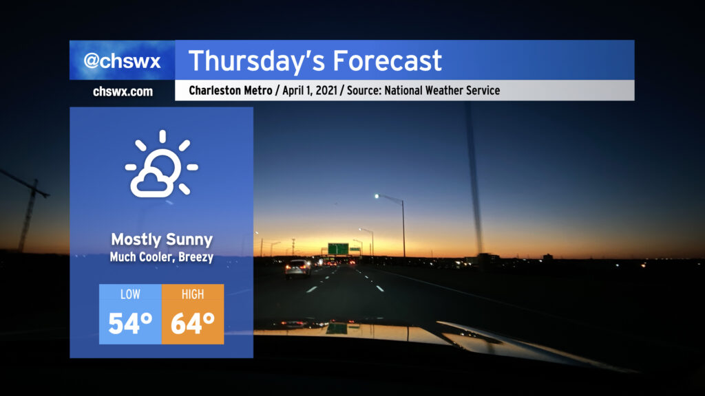
It was a busy weather evening, with numerous reports of hail inland from the coast, a lot of lightning, and a lot of heavy rain. The storms will give way to a cold front swinging through overnight, and by Thursday morning, we will begin to see quite a cooldown. We’ll go from a high of 82° on Wednesday to highs struggling into the mid-60s for Thursday. (No fooling.) It’ll be breezy in the wake of the front, too. However, the sun will be out, and the early April sun angle will feel pretty good when balanced with the cooler air temperatures.
Friday and the weekend: Frost and freeze concerns Friday and Saturday mornings, but springlike weather resumes Sunday
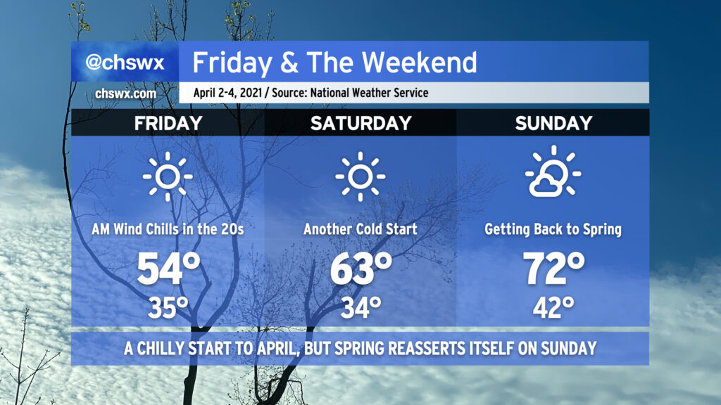
What looks to be Winter’s final hurrah is set to close out the work week. Friday morning, lows will bottom out in the mid-30s away from the immediate coast, with freezing temperatures possible further inland. We’ll need to see how winds and relative humidity cooperate for frost potential, but I’ll advise everyone to protect plants and pets for Friday and Saturday mornings.
Friday’s highs in the mid-50s are below normal for January, much less April, and this is despite full sunshine — illustrating just how chilly of an airmass this is. Temperatures warm up a little for Saturday, but remain well below normal in the low 60s. By Sunday, though, the April sun will have modified the airmass nicely, getting temperatures back into the low 70s in the afternoon.
Chilly weather fans, soak it in — this might be it for a while!