Midday update: Rain moving into the area
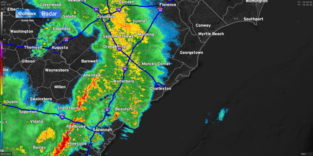
It’s been a while since there’s been anything of consequence on radar, but we are beginning to see some rainfall move into the Tri-County from the west now. Some embedded downpours and rumbles of thunder are certainly possible, but the severe weather threat remains low and should stay that way through the evening. Now that we have seen how storms are evolving, the risk for severe weather looks greatest along and south of Interstate 16 in Georgia. A tornado watch is up for Southeast Georgia until 6PM as a squall line moves through. This line stretches from Georgia southwestward into Florida, with the worst of the weather looking to stay south of the Charleston Metro Area.
A couple more rounds of heavy rain are possible through this evening, and we will still need to watch the 6:43 PM high tide very closely for the potential for flooding, especially if heavy rain is ongoing at that time. There remains a marginal risk that one or two storms could still become severe, too, so be sure you can still receive warnings this afternoon and evening. However, a widespread severe weather event is becoming increasingly less likely.