Severe risk continues to lower; more rain possible through tonight
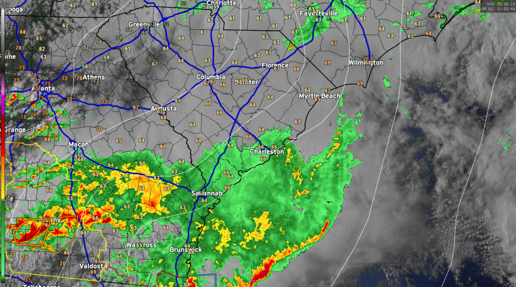
We are largely hitting a lull in the rain across the area early this evening. Temperatures have settled into the mid-60s across the area, with skies remaining very overcast. Today’s rain has tamped down the severe weather threat pretty well, and with light showers still in the area and the amount of daylight waning, we should be in decent shape. Given the dynamics, one cannot totally rule out an isolated storm with gusty winds or hail, but the risk is very low.
Our next round of rain is likely taking shape to our west, where the airmass did get time to recover and another round of strong to severe thunderstorms is ongoing. This activity will weaken as it heads eastward, but may hang on enough to bring more substantial rain into the area. Radar estimates suggest that we’ve generally received anywhere from .25-.75″ across much of the Tri-County, with the highest amounts in southern Charleston County as well as between 17-A and I-95 in Berkeley and Dorchester counties. It’s been a pretty decent soaking, and the good news is that there have been no flooding concerns of note so far.
Based on current timings, it looks like we will get past high tide before any more heavy rain moves in, which is good news for downtown. Of course, we’ll keep an eye on things until the cold front swings through late tonight, but so far, it’s turning out pretty good for us.