The week ahead: Warming up and mostly rainfree; tidal flooding possible in the evenings

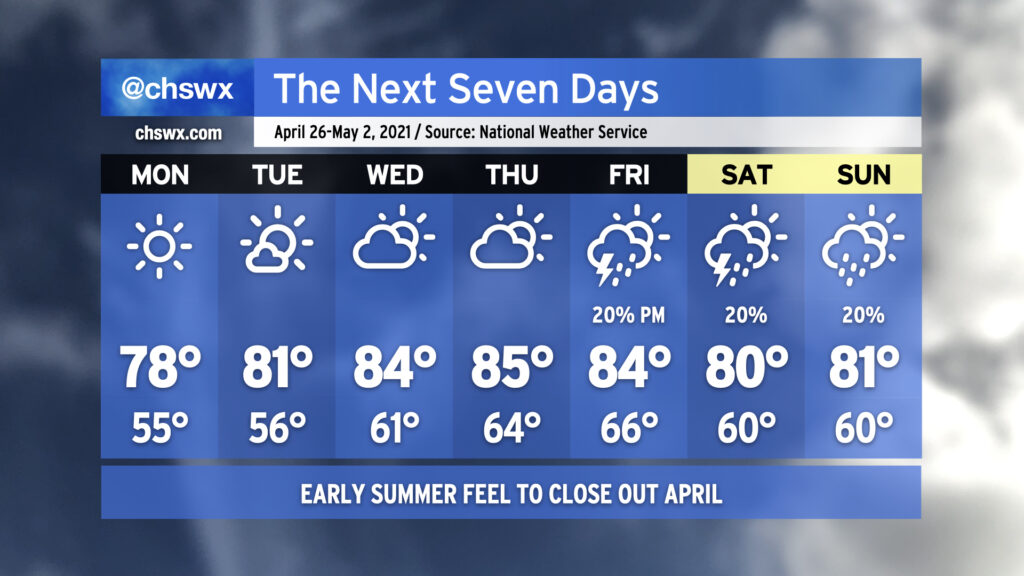
April will come to a close in a very familiar way: Warm and rain-free. Monday looks excellent, weather-wise, with clear skies and highs topping out in the upper 70s in the afternoon with an onshore breeze. High pressure will slowly slide offshore over the next few days, and the resulting return flow along with pronounced ridging aloft will allow temperatures — and dew points — to creep up as the week goes on. By Thursday, we’re doing mid-80s in the afternoon ahead of a cold front. The forecast picture becomes somewhat murky as we head into the weekend, with some solutions keeping us rain-free and others bringing showers and thunderstorms into the area. NWS split the difference for now and is indicating a 20% chance of showers and thunderstorms Friday-Sunday, with the expectation that this is going to change. So, stay tuned.
Coastal flooding a concern around evening high tides

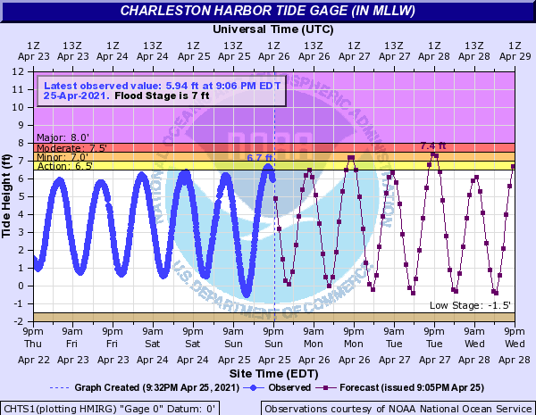
Did you see that big moon tonight? It goes full tomorrow, and with it making a closer pass (perigee), we’ll be dealing with coastal flooding around the times of the evening high tide to at least start the week. It’s been a fairly quiet period for coastal flooding, as is customary in spring. The last coastal flooding event was fairly minor, a 7.04′ high tide on March 30. We’ll see minor to moderate coastal flooding this go-around, with a 7.4′ high tide forecasted for Tuesday evening. Guidance suggests we’ll be dealing with coastal flooding with each evening high tide through at least Thursday, so keep an ear out for Coastal Flood Advisories from the National Weather Service.
Follow my Charleston Weather updates on Mastodon, Bluesky, Instagram, Facebook, or directly in a feed reader. Do you like what you see here? Please consider supporting my independent, hype-averse weather journalism and become a supporter on Patreon for a broader look at all things #chswx!