Rest of tonight: Showers and thunderstorms tapering off after midnight
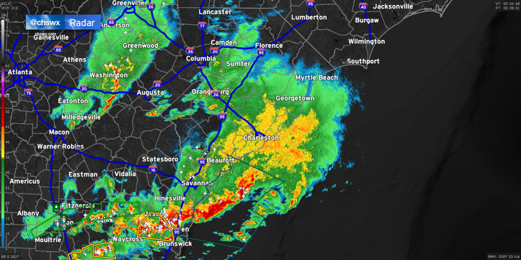
Radar continues to show light to moderate rain moving across much of the Lowcountry late this evening, with some embedded pockets of heavier rain. Showers and a few thunderstorms will remain possible for the next couple hours before tapering off after midnight. Most of this should be out of here by 2-3am.
The risk for severe weather has ended across the Charleston Metro Area, and tide levels continue to retreat after peaking shy of 6.4′ MLLW earlier this evening, so there are no further major weather concerns tonight.
Many spots saw over 1″ of rain based on reports. It’s much-needed, and it’s sure great to get it without all the extracurricular activity. We’ll have a few days to dry out before the next risk for rain arrives later next week.
An increasingly sunny Sunday ahead
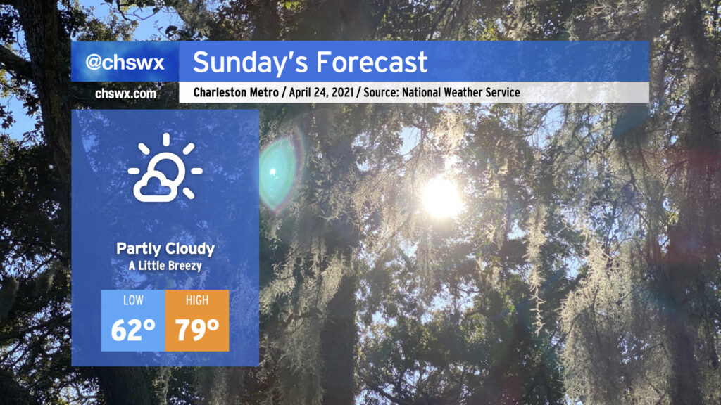
Sunday looks to increasingly live up to its name as cloud cover decreases throughout the day. Downslope flow behind the front will allow temperatures to get into the upper 70s in the afternoon, warming us up and drying us out nicely after the first measurable rainfall in April. Winds could be a little breezy with gusts to 20 MPH at times, but it’s nothing we can’t handle. Enjoy!
Follow my Charleston Weather updates on Mastodon, Bluesky, Instagram, Facebook, or directly in a feed reader. Do you like what you see here? Please consider supporting my independent, hype-averse weather journalism and become a supporter on Patreon for a broader look at all things #chswx!