The week ahead: Unsettled, turning chilly, but recovering for the weekend
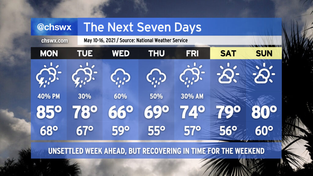
After an excellent weekend of weather, we’re back into a bit of an unsettled pattern for the work week. Monday should be mostly dry to start, but showers and thunderstorms will be possible in the afternoon as mid-level energy works its way through the area. Highs will top out in the mid-80s with humidity making it feel a little warmer.
We’ll begin to see a frontal boundary sink into the area on Tuesday, bringing another chance for scattered showers and thunderstorms throughout the day. As the front sinks southward, a wedge of high pressure will begin to build in from the north and northeast, spelling a chilly (by mid-May standards) couple days for Wednesday and Thursday with highs only topping out in the mid-to-upper 60s. Rain looks likely as moisture overruns the wedge, and we sure could still use it as abnormally dry conditions persist across the Lowcountry.
By Friday, we begin to see drier high pressure reassert itself. Rain chances will remain with us especially in the morning before clearing the way for another gorgeous weekend of weather. (I like it when the pattern works out like this!)