Picture-perfect Memorial Day ahead
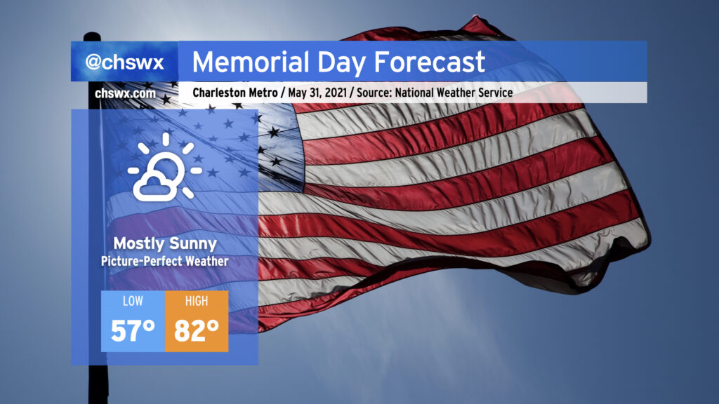
We will commemorate Memorial Day and close out May with picture-perfect weather. Lows will run 5-10° below normal away from the immediate coast, warming nicely into the low 80s under mostly sunny skies as high pressure remains in control over the Southeast. Onshore flow will keep temperatures cooler closer to the coast, with upper 70s likely as high as we get there. Humidity will be comfortable with dewpoints in the mid-50s, too. As we know, this is increasingly rare air for this time of year, so be sure to take advantage as the rest of the work week turns a little warmer and increasingly unsettled.
Record low maximum temperature set on Sunday
The record low maximum temperature at the airport climate site for May 30, which had previously stood at 74° set in 1984, was broken on Sunday with a high of 72° recorded at the airport. A cool wedge of high pressure — something we associate much more with the cool season — remained firmly in place across the region today, and with just enough moisture trapped under an inversion, overcast stayed steadfast. Factor in cool and occasionally gusty northeast winds within the wedge, and that’s how you get such a low temperature so late in the year. We won’t see a repeat performance on Memorial Day with temperatures expected to run about 10° warmer overall, but lower-than-normal temperatures will persist into at least mid-week.
Meteorological summer begins June 1
Finally, as we close out May, we also close out meteorological spring, which runs March 1 to May 31. Temperatures this spring were pretty much middle-of-the-road while ranking in the top 25 driest springs on record (records begin in 1938 at the airport). Three days this spring contributed to over half of the rainfall (4.23″) we received this spring: March 3rd’s 1.25″, April 24’s 1.31″ (which was also the only day in the month of April that measurable rainfall was recorded), and just this past Saturday when 1.67″ fell at the airport during a late evening thunderstorm. Overall, there were only 15 days this spring when measurable rainfall was recorded, which comes in second for fewest measurable rain days behind 15 days in 1986!
Follow my Charleston Weather updates on Mastodon, Bluesky, Instagram, Facebook, or directly in a feed reader. Do you like what you see here? Please consider supporting my independent, hype-averse weather journalism and become a supporter on Patreon for a broader look at all things #chswx!