Turning warmer for Tuesday, with isolated to scattered PM storms possible
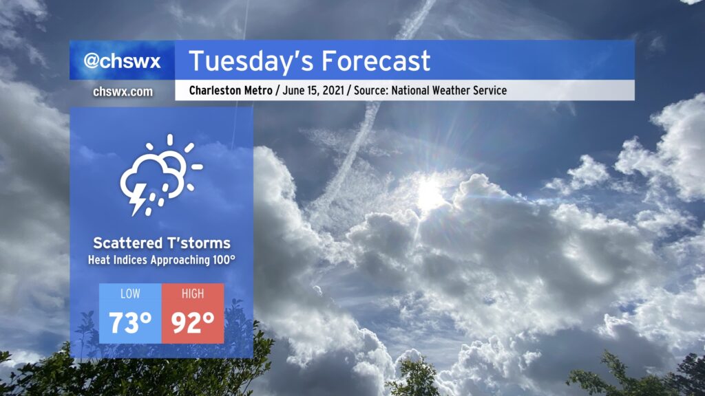
Typical June weather continues for Tuesday. Temperatures will head up into the low 90s in the afternoon as westerly winds keep the seabreeze pinned to the coast. We’ll want to keep an eye on an upper-level disturbance as it swings through; this could help a few storms to get going in the afternoon, especially if the seabreeze can make some inland progress. There will be enough instability to support storms if enough lift is realized, and dry air in the mid-levels could portend a risk for isolated damaging wind gusts. So, we’ll keep an eye on this, but it is more likely than not we get through Tuesday rain-free in a vast majority of spots — good news as we dry out from this past weekend’s deluge.
Tropical update: Bill forms, but is no threat
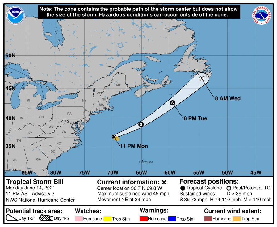
Earlier today, Tropical Depression Two formed off the North Carolina coast as it interacted with the Gulf Stream and gained tropical characteristics. With the 11 PM advisory, it has become Tropical Storm Bill, the second named storm of 2021 and the first within the bounds of the traditional Atlantic hurricane season (Ana formed back in May). This will be short-lived as it accelerates northeast away from the continental United States and is no threat to us here at home.
Follow my Charleston Weather updates on Mastodon, Bluesky, Instagram, Facebook, or directly in a feed reader. Do you like what you see here? Please consider supporting my independent, hype-averse weather journalism and become a supporter on Patreon for a broader look at all things #chswx!