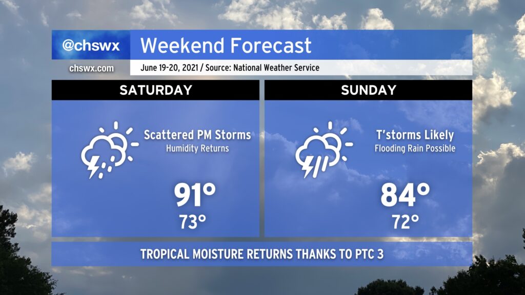
Tropical moisture returns for the weekend, with heavy rain and a strong storm or two possible Sunday
It’s been a great couple days of weather in the Lowcountry, but the remnants of Potential Tropical Cyclone Three look to bring unsettled weather back beginning Saturday afternoon.
Saturday turns more humid with PM storms
The first federally-recognized Juneteenth will feel noticeably more humid as the tropical airmass ahead of PTC 3 moves into the area. Heat indices will top out in the upper 90s before showers and thunderstorms fire along and ahead of the seabreeze. Storm motions will be toward the coast, so stay weather-aware if you are headed out to the beaches. As we get further into Saturday evening, we’ll see rain chances increase from the west as the main moisture plume associated with PTC 3 arrives.
Expect some heavy rain Sunday, but the details remain unclear
Sunday’s forecast details aren’t terribly clear as of yet. There is quite a bit of disagreement between the models as far as the strength of the storm’s circulation and where it tracks. What we can surmise is that heavy rain will certainly be possible given quite a bit of atmospheric moisture in place. Additionally, the track of the low and the upper-air configuration could be conducive to a couple strong to severe thunderstorms, with perhaps even a tornado possible.
What is less clear is exactly when it will rain. Convection-allowing models suggest that there will be a lull between Sunday morning and afternoon. Sometime in the afternoon and evening hours, a round or two of showers and thunderstorms will move through the area. It is within these bands where the heaviest rain could fall, with 1-2” expected across much of the area with locally higher amounts possible. Where the longest-duration heavy rain sets up is highly track-dependent; right now the best probability of the heaviest rain looks to be in the Midlands and points north. However, excessive rainfall will still be possible in the Lowcountry given our recent drenching, so we will need to stay alert for the potential for flooding.
Stay tuned to forecast updates throughout the weekend as the details become more apparent. With any luck, Father’s Day won’t be a total washout, but that’s going to be very much up to details that are still difficult to resolve as of this evening.
Follow my Charleston Weather updates on Mastodon, Bluesky, Instagram, Facebook, or directly in a feed reader. Do you like what you see here? Please consider supporting my independent, hype-averse weather journalism and become a supporter on Patreon for a broader look at all things #chswx!