Partly cloudy today; keeping an eye on a tropical wave for tomorrow
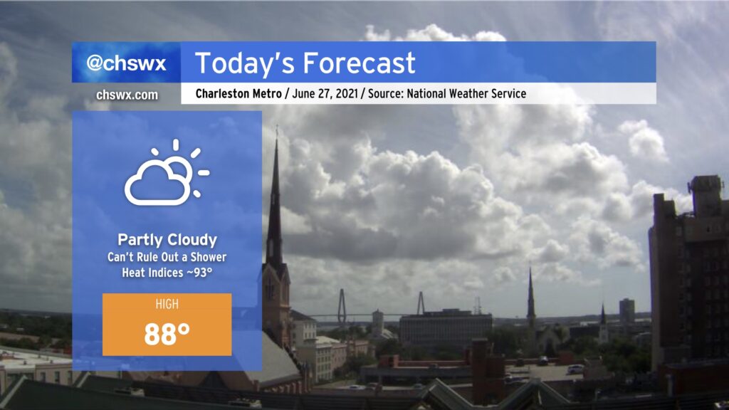
So far, Sunday has run a little drier than previous days without a better forcing mechanism to kick off showers and thunderstorms. While a shower or two cannot be totally ruled out, most of us should stay dry today as highs head into the upper 80s. Humidity will make it feel closer to the low 90s, especially right in the wake of the seabreeze passage this afternoon. Onshore flow will continue, and we should still see a decent breeze at the beaches throughout the day. All in all, not too shabby for the last Sunday in June. (Hard to believe, isn’t it?)
Tropical wave brings showers tomorrow
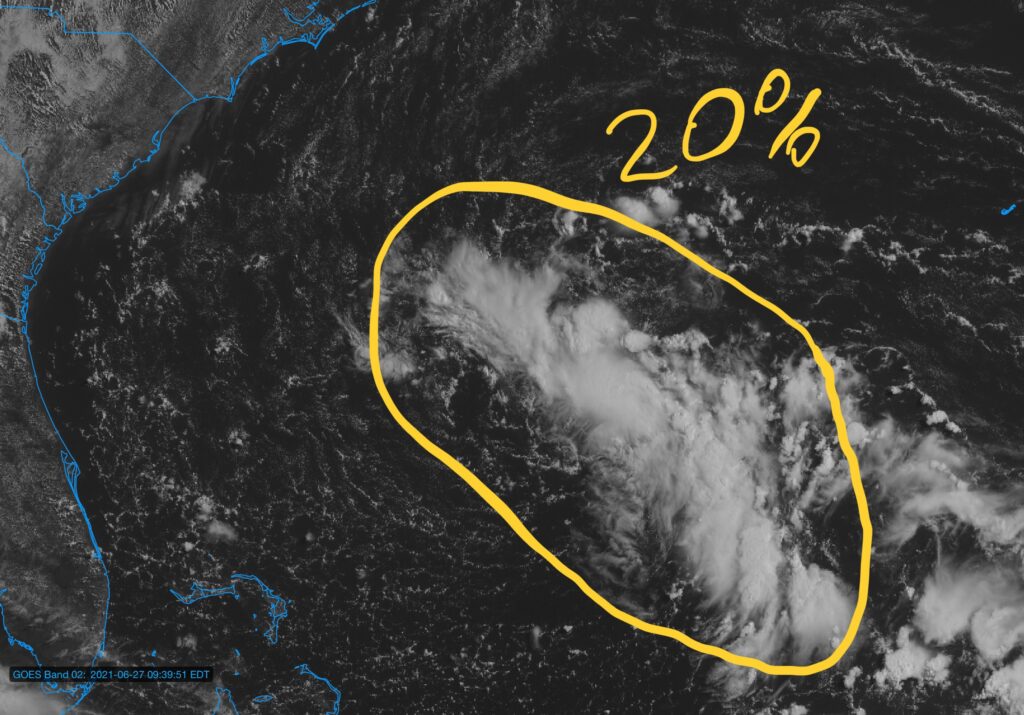
The National Hurricane Center is watching a trough of low pressure about a day away from the Southeast coast for a small chance — 20%, to be exact — that it could close off a circulation and briefly become a tropical depression or storm. This is one of those early-season cases where the effects don’t change too terribly much if this does happen, as tropically-enhanced showers and thunderstorms remain in the forecast for Monday regardless.
Last night’s high-resolution ensemble package brings the best probability for the heaviest rainfall south of the Tri-County area, generally into far southern SC into Georgia. We’ll want to keep an eye on model trends throughout the day to see if there are any changes. If there is any heavy rain tomorrow, it may very well end up in coastal areas, so trends will be watched closely for an isolated flooding threat. I’ll have more on this in tonight’s post.
Enjoy your Sunday!
Follow my Charleston Weather updates on Mastodon, Bluesky, Instagram, Facebook, or directly in a feed reader. Do you like what you see here? Please consider supporting my independent, hype-averse weather journalism and become a supporter on Patreon for a broader look at all things #chswx!