Conditions to deteriorate later Wednesday as Elsa approaches the area
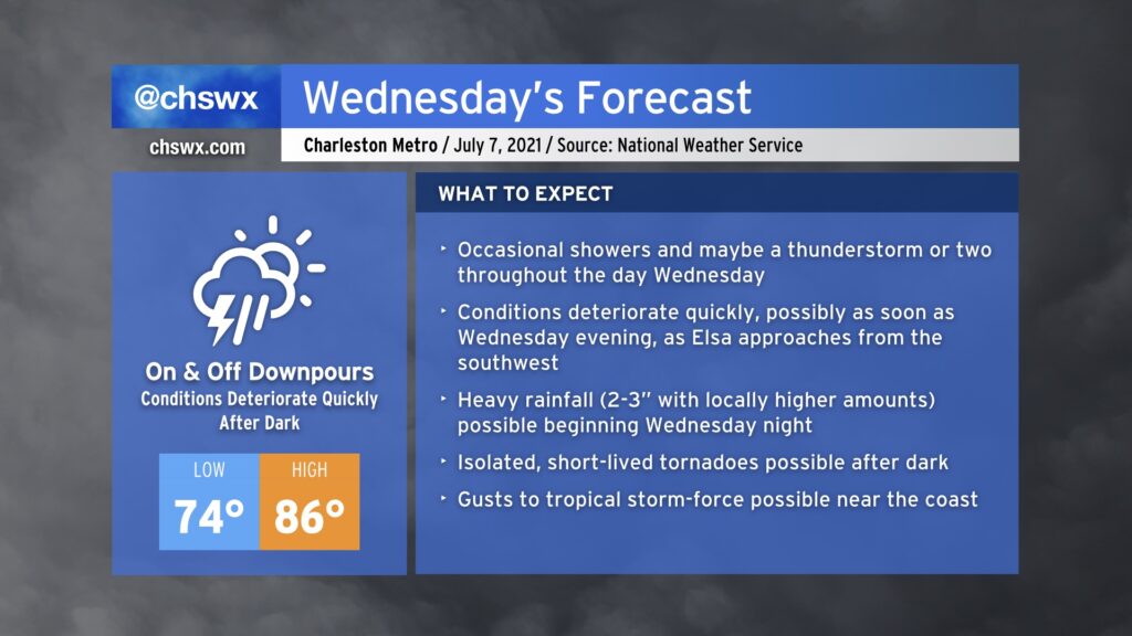
The weather spotlight turns sharply onto Hurricane Elsa as it becomes the primary weather-maker for our neck of the woods through Thursday evening. Based on the current National Hurricane Center track, it looks as if the bulk of the bad weather associated with Elsa will arrive later Wednesday, with periods of very heavy rain being the overwhelming concern through Thursday morning.
Elsa regains hurricane status as it approaches a Florida landfall
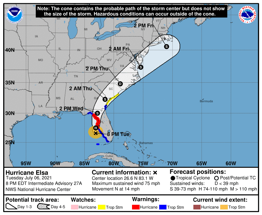
As of the 8PM advisory, Elsa was riding up the Gulf Coast of Florida, gaining enough strength to be classified as a hurricane once again with maximum sustained winds of 75 MPH. In the last couple hours, its radar appearance has improved markedly, indicating a ragged — but closed — eye feature at times when you look at it from Tampa’s radar. It’s not out of the question to see Elsa gain a little more strength before landfall in Florida, either. From there, Elsa will turn a little more northeast and more-or-less head up I-95 through the Carolinas late Wednesday into Thursday, likely making its closest pass to Charleston as we wake up Thursday morning, all the while weakening back to a tropical depression as land interaction disrupts the storm.
Rainfall impacts
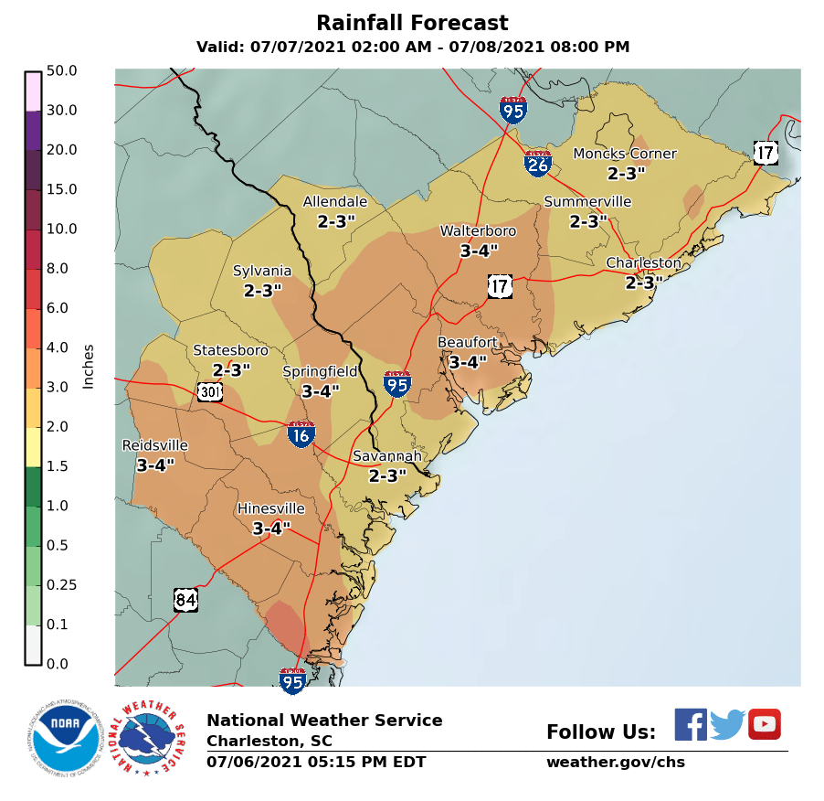
The latest National Weather Service forecast generally paints 2-3” of rain across the Tri-County, with localized heavier amounts within rain bands. This will certainly bring about some flooding concerns across the area, though NWS has held off on issuing a Flash Flood Watch for now.
Model guidance calibrated for the NHC forecast track generally depicts the timing for the heaviest rain to be around or after dark here in the Charleston metro. While it appears that the heaviest rainfall could miss high tide by a few hours, excessive rain rates can be more than enough to make roads impassible for a time. I’d try to limit travel Wednesday night in particular given that seems to be the timing of the heaviest rain.
Minimal surge impacts expected, but timing of rain with high tide still needs monitoring
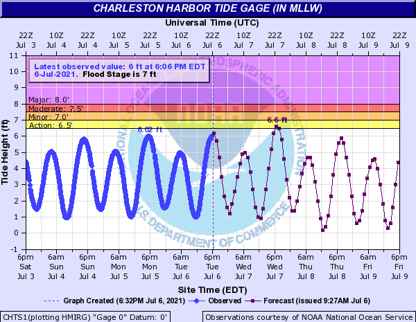
As long as Elsa sticks with the NHC timing, we should overall be spared a more widespread coastal flooding event than we might typically see with a landfalling tropical cyclone. Water levels could approach 7’ in the harbor briefly Wednesday evening, and we’ll want to monitor that for potential minor coastal flood impacts. Of course, even if salt water doesn’t get involved, freshwater flooding from heavy rainfall remains a very real concern, especially if a band is timed near high tide. We’ll want to watch these trends very closely.
Isolated tornado threat Wednesday night
As Elsa’s right-front quadrant moves into the area, there will be a risk for short-lived tornadoes likely beginning Wednesday evening into Wednesday night. Tropical tornadoes are notoriously difficult to detect, tend to move quickly, and are an overall pain in the rear for any well-meaning warning forecaster. You’ll want to make sure you have redundant weather alert devices that can wake you, such as a NOAA Weather Radio with audible alerts and your smartphone, in case a Tornado Warning is issued for your location. The tornado threat doesn’t look terribly extreme, but any risk of tornadoes — especially at night — deserves respect. Wednesday night will be a night to leave the phone off Do Not Disturb so you can hear any warnings that are issued.
Tropical storm-force winds possible at the coast
Finally, there will be the risk for tropical storm-force wind gusts near and at the coast Wednesday night into Thursday morning. This risk will be highly modulated by the strength of the storm as it gets closer to us. Keep in mind that rain bands can pull down stronger gusts from aloft, too, and bring those gusts fairly well inland. With soaking rain, too, you don’t need as much wind to bring trees and power lines down, so I’d still be ready for isolated to scattered power outages (which are not uncommon this time of year when summer thunderstorms get going).
Bottom line: A big rainmaker
The bottom line to Elsa is that it’s primed to be a big rainmaker for the Lowcountry in a summer that has had quite a few big rain-making storms so far (at least in some spots). The good news about that is that it’s nothing that we can’t handle as long as we all do our part to stay out of flooded roadways. Just stay alert to forecast updates, keep your weather radio close, and stay tuned here and on Twitter for more information as needed.
Follow my Charleston Weather updates on Mastodon, Bluesky, Instagram, Facebook, or directly in a feed reader. Do you like what you see here? Please consider supporting my independent, hype-averse weather journalism and become a supporter on Patreon for a broader look at all things #chswx!