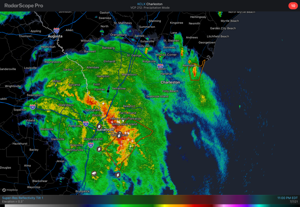
We continue to monitor Tropical Storm Elsa as it moves through southeast Georgia overnight tonight. A Tornado Watch is in effect until 5am across the Lowcountry. The primary concern for tornadoes will be a strong feeder band that is moving north of Savannah into far southern SC as of this writing. It looks like this band will move into the Charleston metro area in the 1-3am timeframe. This band will produce the heaviest rainfall — observers have measured 3”/hr rain rates from this band in Georgia — and provide the best opportunity for an isolated tornado over the next few hours. Discrete cells ahead of this band could also briefly produce tornadoes.
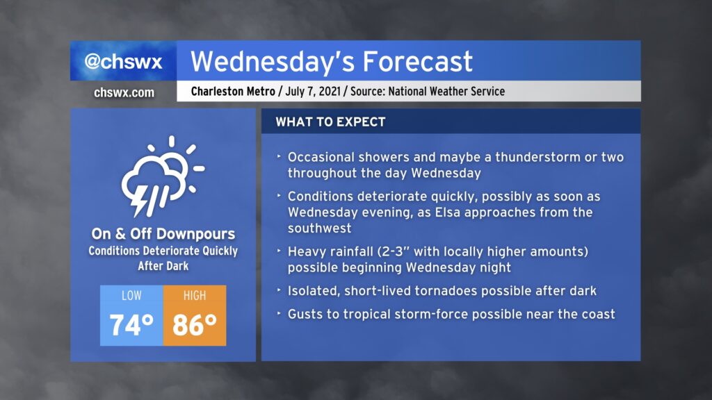
The weather spotlight turns sharply onto Hurricane Elsa as it becomes the primary weather-maker for our neck of the woods through Thursday evening. Based on the current National Hurricane Center track, it looks as if the bulk of the bad weather associated with Elsa will arrive later Wednesday, with periods of very heavy rain being the overwhelming concern through Thursday morning.
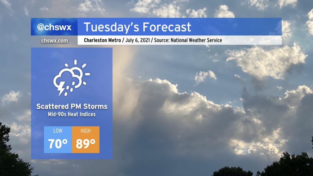
After a remarkably dry Independence Day weekend, we will get back to work and a somewhat more familiar July weather pattern on Tuesday as tropical moisture ahead of Elsa begins to spread northward into the area, enhancing shower and thunderstorm chances in the afternoon. Temperatures will top out in the upper 80s to near 90°, and humidity will push heat indices into the mid-90s. We in #chswx do not expect any direct impacts from Elsa on Tuesday, but it is possible that there will be at least a Tropical Storm Watch put in place by then, so don’t be shocked if one is issued.
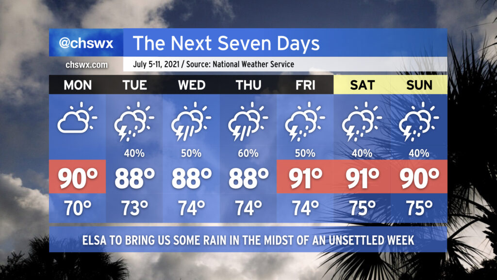
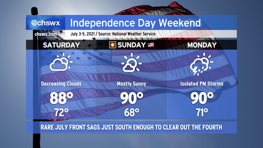
We get one more rain-free day on Monday to close out the observance of Independence Day before moisture and unsettled weather return to the picture. Much of this will be influenced by the eventual track and strength of Elsa, which as of the 5PM advisory, is currently forecast to be a depression as it traverses the area sometime Wednesday into Thursday (more on that in a sec). Overall, get ready for periods of showers and thunderstorms with heavy rain and temperatures right at or a little below normal each afternoon, particularly in the middle of the week as Elsa gets involved with the forecast.
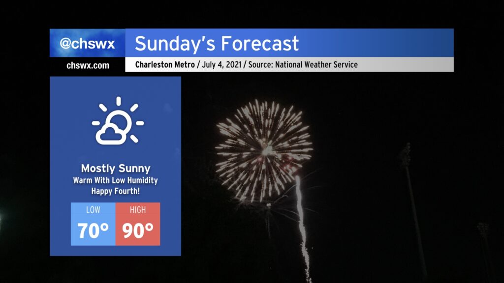
This is going to be one of the better Independence Days for weather in the Lowcountry thanks to an exceedingly rare cold front that came through this morning. Tomorrow will be warm, for sure — highs topping out around 90° away from the beaches — but the humidity (or lack thereof) will be the real story. NWS forecast dewpoints are in the low to mid-60s, which is almost unheard of around here in July. Drier air throughout the atmosphere will keep cloud cover to a minimum, making for a fantastic outdoors day across the Lowcountry. Don’t forget the sunscreen and be safe going to the beach!
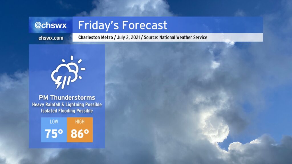
Rainfall this evening has thankfully been a little tamer than forecast, with the bulk of the heaviest rain developing just offshore this afternoon. We will still see a few showers later this evening and overnight, particularly as the cold front currently draped across the Midlands sinks into the area.
Said front will move well south of the area by tomorrow morning, and skies will clear in its wake, yielding what looks to be an excellent Fourth of July weekend. Temperatures will run in the upper 80s to around 90° each day through Monday, with mostly sunny skies for Saturday and Sunday. We may see a couple storms pop on the seabreeze on Monday, but most of us will stay dry. Then after that, we turn to Elsa.
After a couple days in a classic summertime Bermuda High setup, we’ll see that high continue to retrograde eastward, giving way to a cold front sinking south from the Ohio Valley. Said front will run into an incredibly juicy airmass courtesy of a robust moisture tap from the Gulf, and help to ignite numerous showers and thunderstorms in the afternoon. This will have the effect of holding temperatures down into the mid-80s.