The week ahead: Standard summertime fare
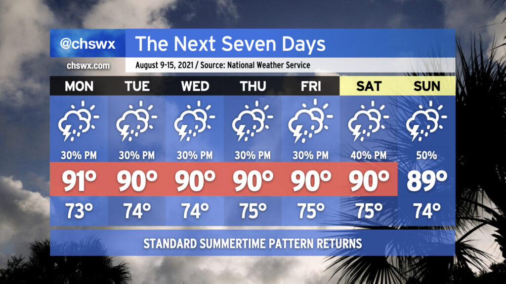
Mercifully, we are headed into a period of relatively normal weather for the next few days. Atlantic high pressure will build in at the surface, and subtropical ridging will move in aloft to click the pattern back into a more standard summertime configuration. Temperatures will top out in the low 90s each afternoon (though the humidity will make it feel closer to 100°), and the inland-advancing seabreeze will be the main focus for any shower or thunderstorm development. Not everyone will see rain every day, and it won’t rain all day at any one location. Just mind the afternoon heat and enjoy the relief if and when you get it.
Tropics are heating up a bit
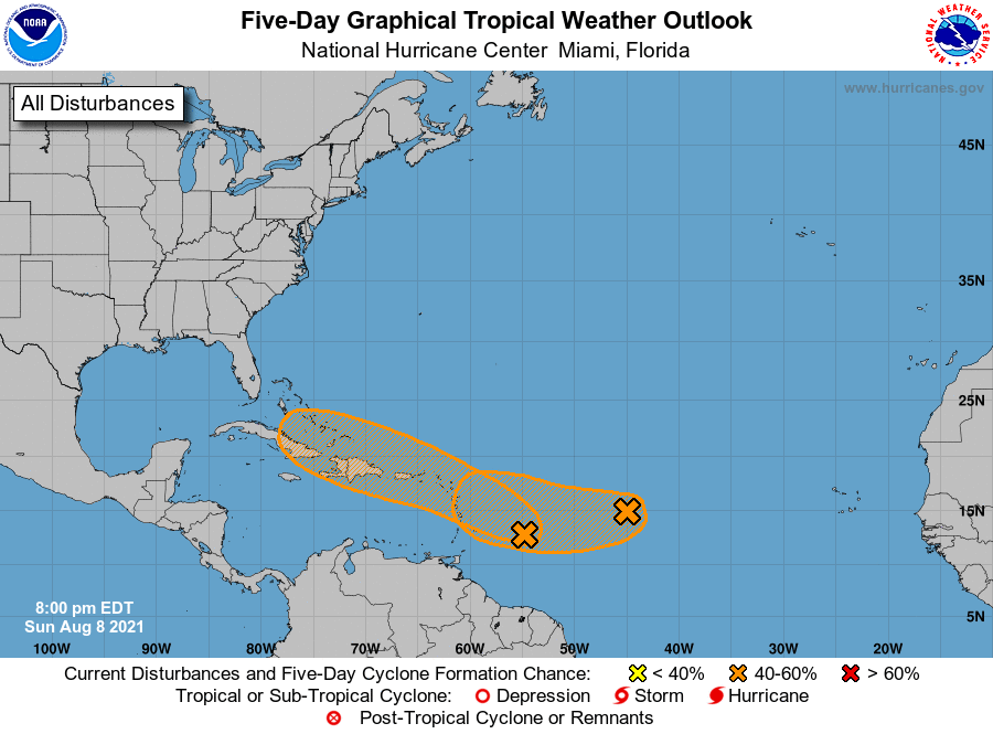
We’re getting to that time of year where the tropics really begin to get going, with the climatological peak of the season on September 10. Seemingly on cue, the National Hurricane Center is watching a couple areas of interest for tropical development over the next five days. We’ll discuss the one with the best shot at it.
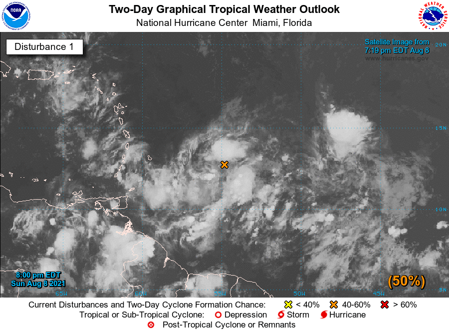
The system with the best shot at development right now, dubbed Invest 94L, is just shy of 55° west longitude. NHC has this at a 50% chance of development in the next two days and 60% in the next five. Models certainly seem to be on board with this developing into at least a depression if not a storm as it heads westward toward and through the Lesser Antilles into the Caribbean. Given where it’s located and the general westward to northwestward motion that is expected to continue, we’re going to want to keep an eye on this wave to see what it does.
For now, though, there are no imminent tropical threats to the Carolinas. This means it’s a really good time to check your emergency kit and shore it up in case this or any other wave looks to give us some grief in the next few months. Most importantly, if you are eligible and medically able to do so, get vaccinated against COVID-19 if you haven’t already begun the process. In the event an evacuation is needed, you will have excellent protection against the virus and will be able to stay well in a critical time for you and your family.
Bottom line: Check back regularly with reliable sources for updates on 94L as needed, but also keep in mind that there isn’t an imminent concern with this yet. We have time to watch it, and if it looks like 94L will become a player in our weather, we in the #chswx enterprise will be sure to keep you posted. For now, though, enjoy a rather normal work week of weather.
Follow my Charleston Weather updates on Mastodon, Bluesky, Instagram, Facebook, or directly in a feed reader. Do you like what you see here? Please consider supporting my independent, hype-averse weather journalism and become a supporter on Patreon for a broader look at all things #chswx!