More scattered storms and mugginess for Wednesday; watching a Gulf disturbance, too
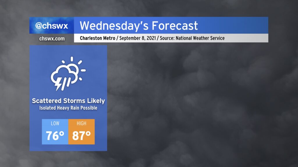
Scattered showers and thunderstorms will once again figure into the forecast for Wednesday. An approaching cold front as well as some upper-level help in the form of a trough will contribute to scattered to numerous storms in the afternoon and evening hours. Brief bouts of heavy rain will be possible, and a few storms could get gusty, but severe weather appears unlikely.
We’ll get off to another muggy start with mid-70s lows. Expect mid to upper 80s until storms get going in the afternoon. Mix in the humidity and it will feel closer to the upper 90s.
Finally, we will want to keep an eye on water levels around the 10:12 PM high tide for the potential for some minor salt water flooding as water levels could get near 7’. We might have some rain in the area around that time, too. Thus, time of high tide will merit close watch.
Watching an area of disturbed weather in the Gulf for possible rainfall enhancement later this week
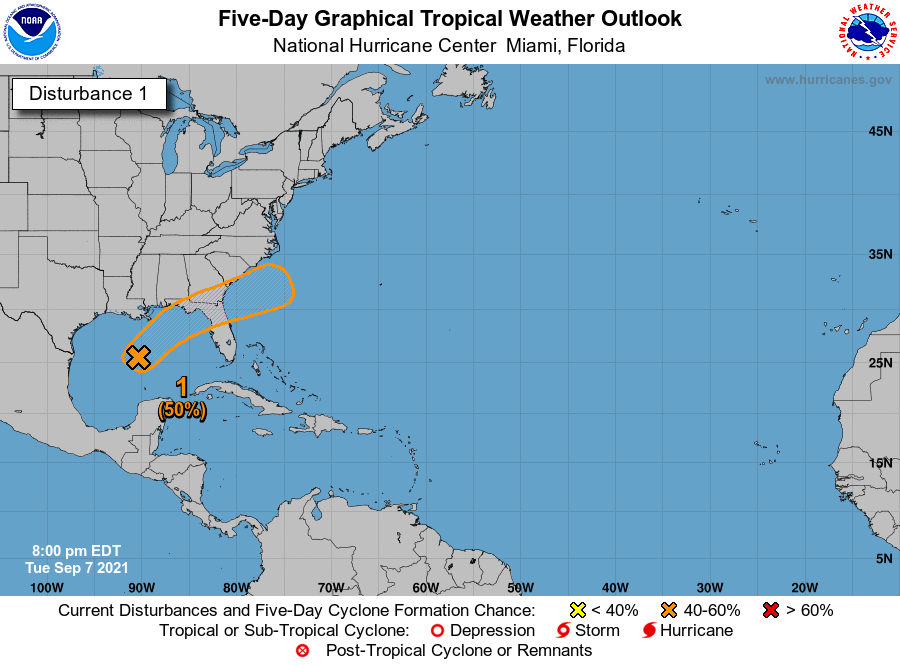
The National Hurricane Center gives an area of disturbed weather in the Gulf of Mexico a 50% chance of becoming a tropical cyclone over the next five days as it heads northeastward toward Florida and southern Georgia. Regardless of whether it develops, this could be a rainfall enhancer here in the Lowcountry particularly as we get into Thursday. For now, no specific impacts beyond that are expected, but we’ll keep an eye on it all the same.
Hurricane Larry, despite being thousands of miles from the continental United States, is still making its presence felt here through quite a bit of wave energy. This will help enhance the risk of rip currents over the next few days, so if you do have any post-Labor Day beach plans, be aware of this and stay out of the water if you are not an experienced swimmer.