Warmer on Wednesday, then a dry front cools things back off a bit
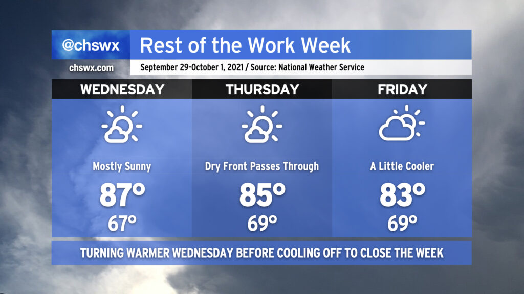
The temperature curve is very much respecting Wednesday as Hump Day with highs topping out in the upper 80s, as high as they’ll get this week before gradually coming down for Thursday and Friday as a dry cold front sinks south across the area. Mornings will remain a little on the warmer side, with upper 60s to low 70s common across the metro area, warmest near the beaches and coolest inland.
We’ll remain rain-free despite a front coming through Thursday as moisture remains in limited supply. In fact, the first appreciable rain chance we’ve seen in more than a week will probably arrive on Monday or Tuesday, and even then right now the chances are pretty slim.
The tropics remain busy as Hurricane Sam continues to churn in the Atlantic. There are also two areas of interest in the far eastern Atlantic that are very likely to exhaust the primary name list for the second consecutive season, but neither those areas nor Sam are a threat to the Carolinas as we move into October.