Friday & the weekend: Stormy start, but we salvage Sunday
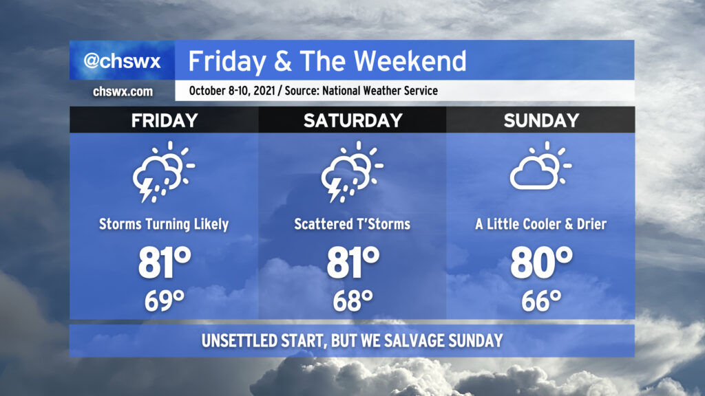
Our unsettled pattern continues into the weekend as low pressure meanders offshore and we stay within some troughing aloft. Another round of widespread rain will characterize Friday as storms develop in GA and move northeastward through the afternoon. From there, scattered showers and thunderstorms will persist into Saturday before the aforementioned low pressure moves a little further away to our north and east, allowing for some drier air to filter in from the north to keep Sunday rain-free and a little more comfortable to boot.
Astronomical influences and onshore winds will continue to cause coastal flooding issues around times of high tide through the weekend. Moderate coastal flooding is in the forecast for high tide around 9:58 AM Friday. With the forecast between 7.5-7.7′, we can expect some road closures to occur in and around Downtown Charleston. Another round of moderate coastal flooding, which could peak even higher, is expected Saturday morning around the 10:49 AM high tide, causing another round of road closures. As always, we’ll need to see what the rain is doing around this time as well as any water on top would be most unwelcome. Moderate coastal flooding will again be an issue around midday Sunday, but the risk for rain will be much lower than previous days, so the specter of more widespread problems is diminished.
Hang in there — next week is looking drier, at least. True fall weather, though, still appears to be well down the road as elevated dewpoints and ridging aloft will keep temperatures above normal through the end of next week.