Improving weather Sunday as the coastal low pulls away
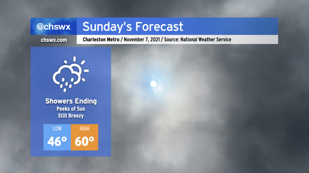
Our weather takes a positive turn Sunday as the coastal storm moves northeast and away from the area. We will see some showers hanging around in the morning, but these will depart as the morning goes on. Expect the sun to begin peeking through by afternoon before sunset at 5:24 PM. (Don’t forget to set your clocks back an hour tonight!)
Temperatures will thankfully respond to the sunshine as well, with highs around 60° in the afternoon. (The normal high for November 7, though, is 72°.)
Winds will remain breezy, with gusts to 30 MPH still a possibility as we remain within a very tight pressure gradient between high pressure to the west and low pressure to the east. Use extra caution on bridges and overpasses once again tomorrow.
There will be a risk for minor to moderate for tidal flooding Sunday morning. Water levels could approach about 7.5′ with the 9:34 AM high tide. Be ready for a few road closures, though certainly nothing to the extent that was seen this morning when the water level peaked at 8.44′, good for 11th highest on record at Charleston Harbor.