The week ahead: Gradual warmup through mid-week before another cold shot
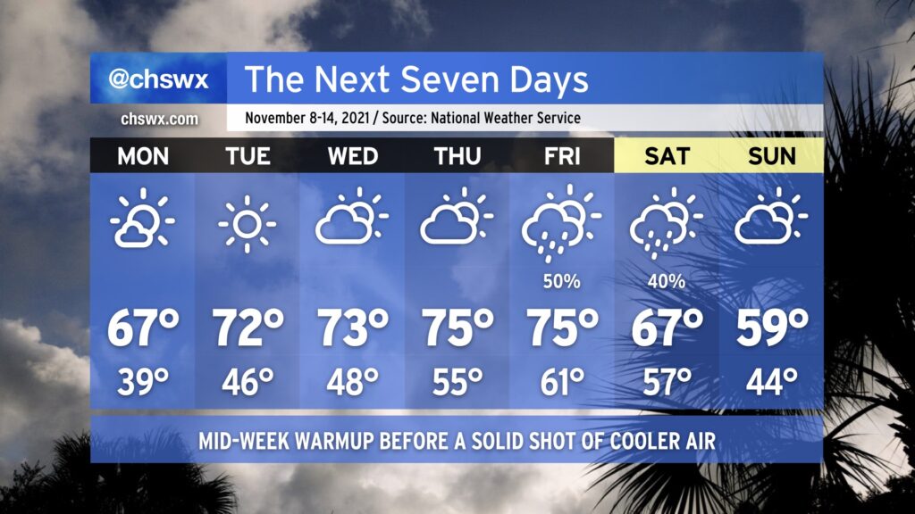
After a tumultuous weekend of coastal flooding, wind, record-low maximum temperatures, and rain, the week ahead offers a nice respite. We’ll start the week chilly, with lows in the 30s away from the immediate coast warming to the mid-60s for Monday. The 70s return for a few days thereafter, with mostly fair weather until a cold front approaches the area late Thursday into Friday, bringing rain chances back into the picture for Friday and perhaps parts of Saturday. Don’t let the sweaters get too far out of reach, though: by Sunday, we’ll be feeling quite a cooldown as highs struggle to reach 60° despite partly cloudy skies.
A coastal flooding threat continues with the Monday morning high tide, which could again approach moderate coastal flood thresholds (7.5’ mean lower low water). High tide is forecast to peak around 10:32am. What’s a few more road closures after this insane weekend of flooding, in which we reached 8’ tides three times, including setting the 10th and 11th highest water levels on record at Charleston Harbor? The good news is that the coastal flood threat winds down thereafter as astronomical influences wane and offshore winds continue.