Back to the 70s to close out the work week
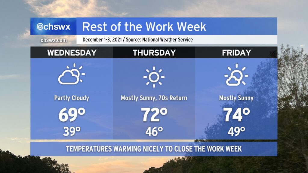
Meteorological winter begins tomorrow, running from December 1 through February 28, 2022. It sure won’t feel like it, though: temperatures will warm to near 70° on Wednesday, and then peek into the low to mid-70s on Thursday and Friday. We’ll have some cloud cover associated with a weak disturbance aloft Wednesday, but other than that, expect quite a bit of sunshine over the next few days.
The only weather concern looks to be a small risk for minor coastal flooding beginning with Friday morning’s high tide as we head toward the new moon phase. So far, the NWS forecast has that tide peaking just shy of 7’, which is the minor coastal flooding criteria. Peeking a little further down the road, guidance indicates that Saturday morning’s high tide may scrape that 7’ threshold as well. So far, though, it certainly does not appear to be a repeat of the last new moon, which brought us top-15 tides during the first week of November.
Finally, we bid adieu to the 2021 hurricane season, which was another extremely busy season in terms of named storms (21). For the second consecutive year, the primary storm name list was exhausted — but we did not have to crack open the supplemental list, at least. Once again, our luck has held here — aside from the quickly-developing Tropical Storm Danny and the nocturnal tornado outbreak associated with Tropical Storm Elsa, it was another rather quiet season for the Lowcountry, and for that I am grateful.