Chilly, raw, damp Tuesday ahead
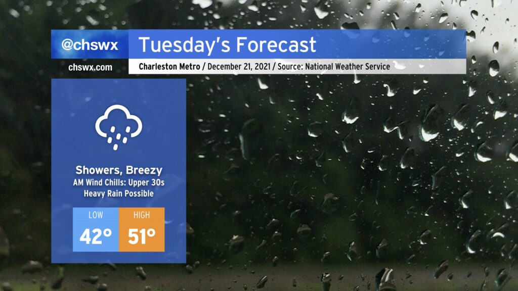
Get ready for an unsettled and chilly Tuesday with rain and breezy northeast winds for much of the day. Rain could start as early as 1-2am, but will peak during the day with up to 1-1.5” possible in spots as low pressure moves northeastward parallel to the coast.
Chilly high pressure will remain wedged into the area through tomorrow, and the interaction between it and the low pressure system will help kick up northeasterly winds, especially at the coast. We could even see some minor salt water flooding with the 9:02am high tide as the wind could push the tidal anomaly close to 7’.
Elsewhere, this wind will make temperatures feel even cooler than they already will be, with wind chills in the 30s possible well into mid-morning. Winds notwithstanding, the forecast high of 51° may very well be optimistic especially given rain falling into the wedge, helping to reinforce the cold air dam across the area.
The good news is that our weather improves beginning Wednesday, and we’ll be on our way to a warming trend with much more sunshine heading into and beyond Christmas.