Slight chance of a shower Tuesday, but most stay dry
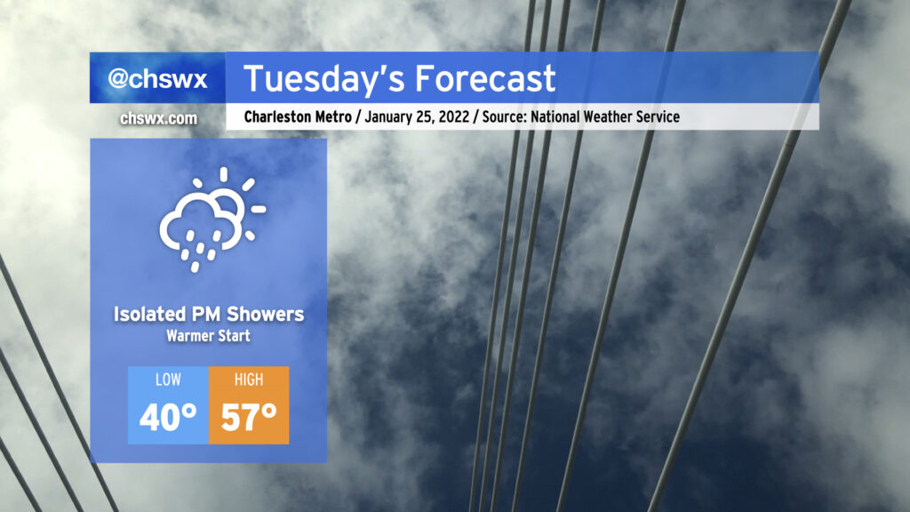
Low pressure moving along the Gulf Coast will keep a little more cloud cover in the area for Tuesday than we saw on this brilliantly sunny Monday. That will have the effect of keeping temperatures right around 40° to start the day, a touch warmer than we started with today and definitely warmer than how we started the weekend. Highs will rise back into the mid-to-upper 50s with winds coming out of the west. This is still cooler than normal for this point in January, but decent considering the expected broken cloud cover in place.
A shower or two will be possible in the afternoon and early evening hours mainly near the coastal areas as the aforementioned low pressure moves on by, but the vast majority of us look to stay rain-free. If it does rain, it may not even be measurable.
I’m also continuing to monitor model trends for scuttlebutt around a potential coastal storm this weekend. If you’re looking for another dose of winter weather, today’s trends aren’t ideal: model agreement has been improving in keeping the low pressure system in question well off our shores, with the GFS and ECMWF now in a bit more agreement on bringing drier air into the area before the colder air arrives. While the two models did a better job lining up today, I’m going to need to see a bit more run-to-run consistency overall before confidence in any one solution can improve.
For its part, NWS has a 40% chance of rain — and that’s it — for Friday afternoon into early Saturday morning, and if you need to be making any decisions about your weekend, that’s the forecast you want to be following. Stay tuned, for future adjustments to the forecast are more likely than not.