Chilly but sunny Thursday ahead of an unsettled Friday
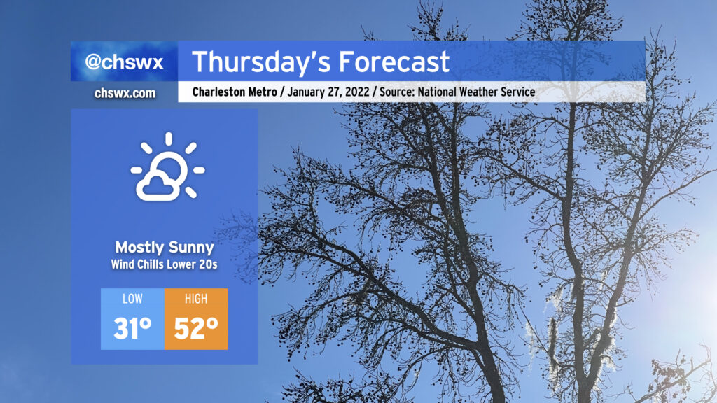
Thursday will start below freezing as cold air continues to push into the area from the northeast. Temperatures generally look to range between the upper 20s well inland to around freezing in the North Charleston area to the mid-to-upper 30s closer to the coast. Factor in the wind, though, and it may feel like the low 20s in spots. Make sure everyone’s bundled up well heading to work or school. Afternoon temperatures top out in the low 50s despite the plentiful sunshine.
As we get into Friday, we’ll be watching the development of a low pressure system off the coast closely. Said low pressure will spread rain into the area on Friday before another shot of Arctic air arrives. There remains a possibility for some flurries or brief snow showers early Saturday morning. The closer the low is, the better shot we have at some wrap-around flurries. Generally speaking, though, cold chasing moisture can be a recipe for winter weather disappointment in the Carolinas, so be sure to set expectations accordingly. Most importantly, no accumulations are forecast, limiting travel impacts. (No freezing rain, either!)
The certain impact from this storm will be the aforementioned Arctic air being drawn southward behind it. We may not get out of the 40s from Friday night through Monday afternoon, with a particularly frigid morning on tap on Sunday with low 20s in the Charleston metro area and the potential for air temperatures in the teens further inland.
Stay tuned to forecast updates on our (thankfully much more conversational) winter weather chances overnight Friday into Saturday morning!