The week ahead: A warm reprieve
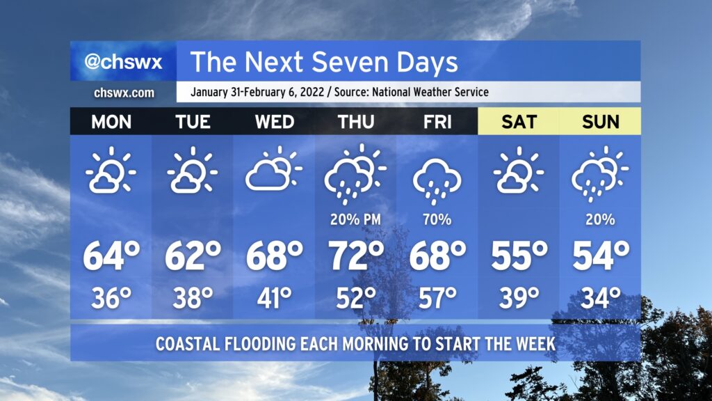
After a couple rather chilly weeks, we’ll give the heavy jackets a bit of a rest as ridging builds in aloft. We start the week with low temperatures in the mid-to-upper 30s and highs in the low-to-mid-60s with plenty of sunshine. Cloud cover ticks up a little bit for Wednesday, but so do temperatures as we get close to 70° in the afternoon. By Thursday, another storm system will be approaching from the west, but we should top out in the low 70s before it starts to get into the area. Right now our best rain chance arrives Friday as the cold front gets through. Saturday will turn much cooler with highs back in the mid-50s. This continues into Sunday, with perhaps a slight rain chance as moisture overruns a wedge of high pressure at the surface.
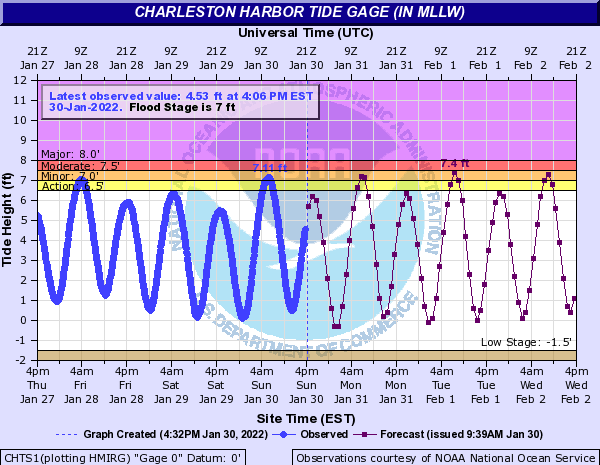
Coastal flooding looks to be an issue during the morning high tides to start the week as the new moon reaches its perigee. Minor flooding looks possible on Monday, with water levels potentially reaching moderate flood stage Tuesday and Wednesday. Times of high tide will increasingly coincide with the peak morning commute heading into mid-week, so be ready for some delays.
Morning high tides:
- Monday, 7:11am
- Tuesday: 8:03am
- Wednesday: 8:52am
Remember: This is salt water, and you’ll want to avoid driving through it in your car. Use alternate routes if you encounter a flooded road.