Rest of the work week: Back to the 70s, briefly
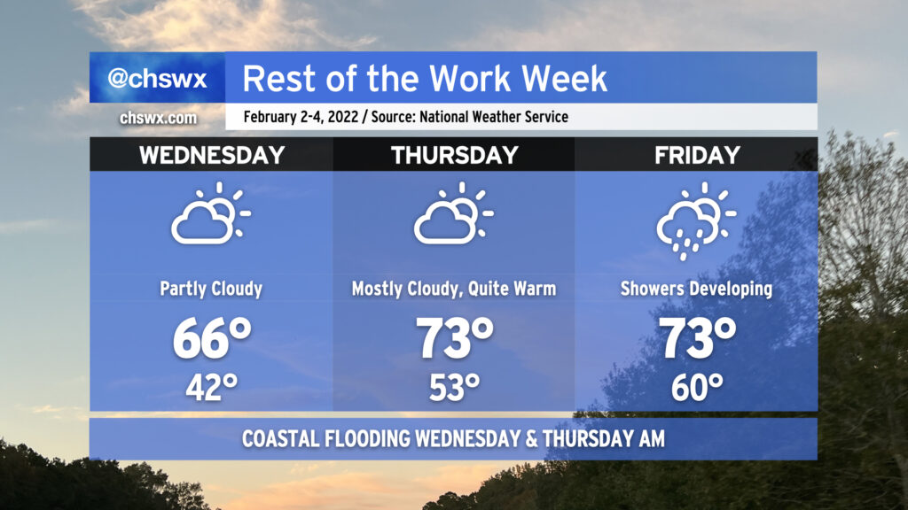
Our warming trend continues as we head toward Friday before a cold front gets by and knocks Saturday back to normal. Wednesday features partly cloudy skies and highs topping out in the mid-60s, while we go even warmer on Thursday — low 70s for highs! — despite increasing cloud cover as the cold front draws nearer. By Friday, we stay in the 70s, but expect showers to begin to develop and move across the area ahead of said front. We turn much cooler for the weekend behind the front, and will likely stay unsettled pending the development of a coastal low that will head northeastward, keeping rain chances in our forecast into the new work week.
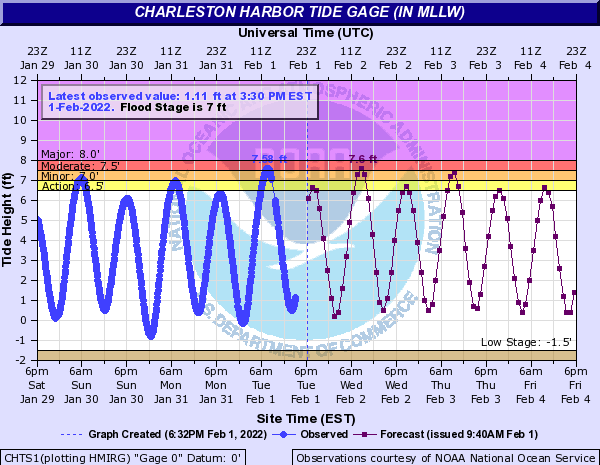
After a 7.58′ high tide this morning that closed a few roads in downtown Charleston, we look to repeat that performance again closer to peak commute time on Wednesday morning. NWS is forecasting a 7.5-7.7′ high tide around 8:52 AM which will once again likely close some roads between 8-10 AM. Be ready to use alternate routes and remember that this will be salt water, which is highly harmful to vehicle undercarriages.
Follow my Charleston Weather updates on Mastodon, Bluesky, Instagram, Facebook, or directly in a feed reader. Do you like what you see here? Please consider supporting my independent, hype-averse weather journalism and become a supporter on Patreon for a broader look at all things #chswx!