Weekend forecast: More clouds, some showers Sunday afternoon and evening
For the third consecutive day, we at least tied the record high at Charleston International Airport. Today’s high was 86°, which matches 2018’s record temperature. Changes are coming, though, thanks to a cold front which will bring this run of record highs to an end.
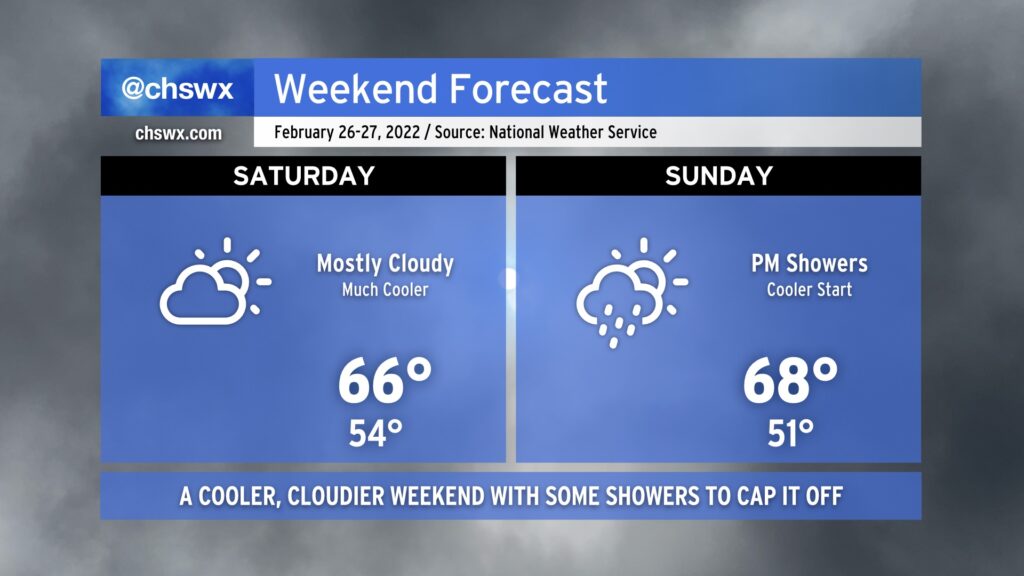
Temperatures on Saturday should run some 10-20° cooler in spots in the wake of the aforementioned cold front. The front itself will come through dry, but expect an uptick of cloud cover behind it on Saturday. Highs in the mid-60s will be common (and much closer to where we should be at this point in the year).
Unfortunately, this weekend doesn’t get in rain-free; expect showers to develop starting Sunday afternoon as an upper-level disturbance ripples through. Highs will top out in the mid-to-upper 60s across the area, though showers could put a damper on that later in the day.
Heading into next week, temperatures will remain around if not a few degrees above normal — though certainly nowhere near the record levels we experienced this week. All in all, above-normal temperatures remain strongly favored as we head into March, but never underestimate the power of one last March freeze to cause problems to start the growing season.