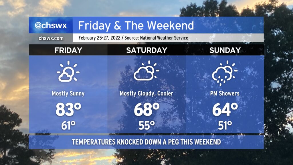
Friday & the weekend: One more exceptionally warm day before temperatures fall closer to normal
For the second straight day, we reached a record high at the airport as the temperature peaked at 84° a little after 2:30 PM. This broke the previous record high of 83° set in 2018. (The normal high for this point in February is 66°.)
The early evening surface analysis showed a wedge front stalled out roughly north of I-20. Ahead of that front, temperatures were in the upper 70s to low 80s. Behind that front, temperatures were in the 60s and below! This front is not going to make it this far south for tomorrow, though, which will allow Friday’s temperatures to once again soar into the 80s under partly cloudy to mostly sunny skies. The record high of 86°, set in 2018, will bear watching.
Patches of fog will be possible in the morning, so be ready for brief disruptions in visibility during your Friday morning commute.
By Friday evening, though, the frontal zone will be moving through the area, yielding a much cooler weekend. Temperatures on Saturday will struggle to the upper 60s under partly to mostly cloudy skies. (68° is still a couple degrees above normal for this point in the year, though.) On Sunday, a few showers will be possible as a disturbance passes by overhead. We’ll run a few degrees cooler with highs generally topping out in the mid-60s in the afternoon.