A few strong to severe storms possible Wednesday afternoon
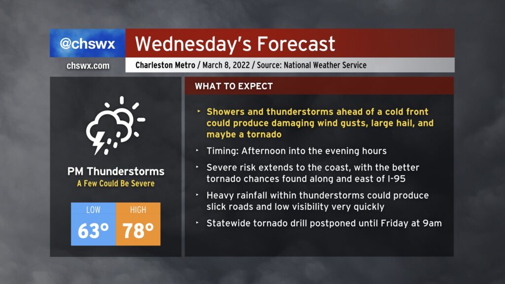
A warm front lifts north of us tonight, putting us squarely in the warm sector of a storm system that will approach the area tomorrow before stalling out nearby Thursday. While we reside in that warm sector tomorrow, good turning of winds with height and decent instability will promote a risk for thunderstorms, a few of which could become severe. The main severe weather risk will be from damaging wind gusts, but if a supercell or two can get going, that will come along with an elevated risk for hail or even a tornado. Suffice to say, you’ll want to stay close to reliable and redundant sources of severe weather information tomorrow afternoon into the evening. NOAA Weather Radio is a great way to get alerts, and if it is enabled to do so, your phone can automatically alert you to tornado warnings, no app required.
Due to the risk of severe weather, the statewide tornado drill originally scheduled for Wednesday morning as part of South Carolina Severe Weather and Flood Safety Week has been moved to Friday at 9am.
We will have a lull in the severe weather threat on Thursday, but expect plenty of showers and even a few thunderstorms to linger as the front remains stalled out close by. Another risk of severe weather is possible late Friday into early Saturday morning as another front approaches the area. This front will bring cold high pressure for later Saturday into Sunday, with the risk of a freeze on Sunday morning.
Stay tuned to forecast updates tomorrow!