Showery Thursday leads into an unsettled start to the weekend before a freeze on Sunday
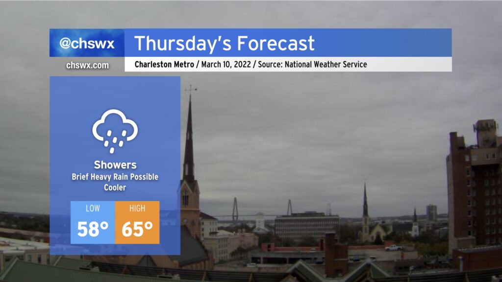
More needed rain will steadily fill in overnight as a cold front gets through the area and promptly stalls out nearby. We’ll see showers continue for much of Thursday before they taper off as the front gets shoved a little further offshore. Temperatures will certainly run much cooler — lows in the upper 50s will give way to highs only in the mid-60s in the afternoon.
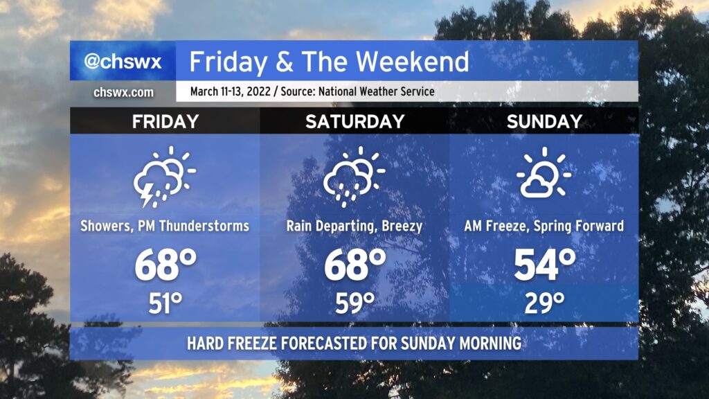
We’ll get a brief break in the rain late Thursday before another cold front approaches during the day Friday with more showers and some thunderstorms late. High temperatures will top out in the upper 60s, generally around normal for this time of year.
Friday night’s thunderstorms could run on the strong side with damaging wind gusts the primary concern. Wind shear’s gonna be there, but as usual, instability is going to be the limiting factor. Keep the weather radios handy just in case.
Rain will continue into Saturday morning, but will be departing by mid-afternoon as the last cold front in this series swings through. It’ll be breezy behind the front and turning much colder as we get into Saturday night and Sunday morning. A freeze is looking quite likely Sunday morning away from the immediate coast; the latest NWS forecast has upper 20s getting into the Charleston metro area. This forecast will need to be fine-tuned still, but it’s something worth watching if you’ve gotten an early start on your garden. Highs will struggle into the mid-50s despite mostly sunny skies, bringing a bit of winter flair to what’s otherwise been a rather warm period to this point since February.