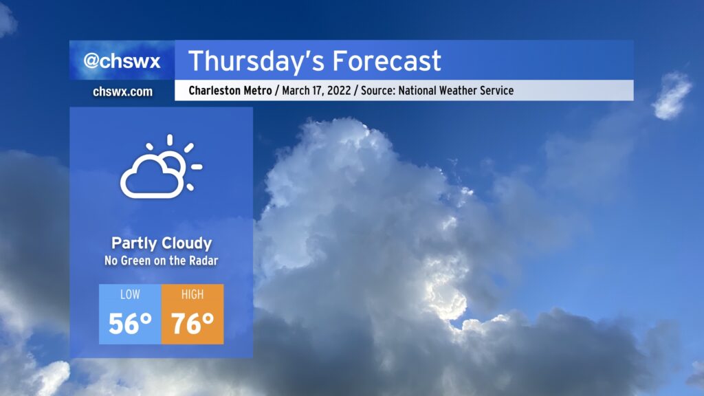
Thursday: Green in your beer, not on the radar
After some beneficial rain so far this Wednesday, we’ll see shower and storm chances taper off this evening as low pressure lifts northeast and away from the area. There is still the risk of a strong to severe thunderstorm for the next few hours (generally through sundown), so we’ll want to be keeping an eye on the radar for the next little bit.
We take a break from rain on Thursday with partly cloudy to mostly sunny skies for St. Patrick’s Day. Temperatures will rise from the mid-50s in the morning to the mid-70s in the afternoon, and dewpoints in the 50s will make for a good middle ground between “too dry” and “too muggy.” Overall, not a bad St. Patrick’s Day, where the beer will hopefully be more green than the radar.
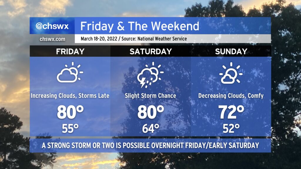
We’ll warm to near 80° on Friday with increasing cloud cover as another storm system moves through the Mid-South on its way to the Mid-Atlantic. Rain chances look to hold off until late, though. A few thunderstorms will be possible overnight Friday into early Saturday morning, and there once again is the potential for one or two of those to produce damaging wind gusts if conditions line up just right. We’ll keep an eye on how this evolves as nocturnal severe weather is, well, sub-optimal.
Slight shower and storm chances persist into Saturday, after which a cold front will come through and help deliver a rather beautiful Sunday with decreasing cloud cover and highs in the low 70s.