Friday & the weekend: Turning unsettled with strong storms possible, but a pleasant Sunday ahead
It’s turned out to be a pretty nice Thursday after a very foggy start. Temperatures topped out in the low-to-mid-70s across the area with plenty of sunshine emerging in the afternoon.
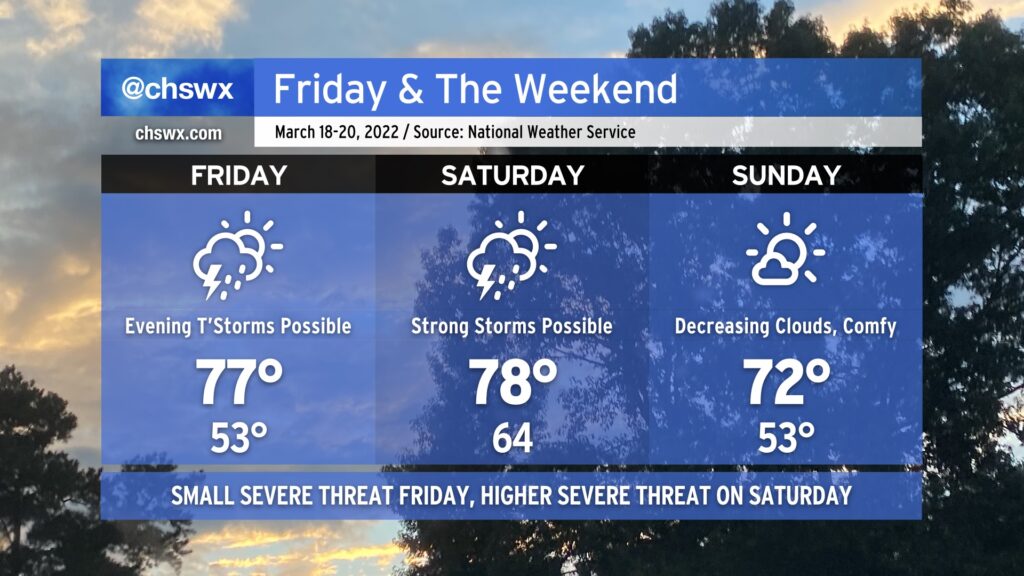
As we head into Friday and the weekend, another storm system will approach the area, bringing with it another round of showers and thunderstorms for some. Much of Friday should remain dry; temperatures ahead of the front will get into the upper 70s under partly cloudy skies. Thunderstorm chances increase with some upper-level energy moving in Friday evening. There’s an outside shot for a storm to briefly become strong or severe, with damaging winds the main concern, but that risk is conditional on whether any instability can develop.
Saturday could have a bit better severe weather threat as the cold front moves through. Wind shear will be favorable, and as long as Saturday doesn’t stay too overcast or showery, some decent instability should develop. This could lead to thunderstorms with damaging winds and large hail. A tornado isn’t off the table, either, with a little low-level shear indicated in the guidance suite. Temperatures look to head into the upper 70s once again before the front gets through later in the day.
Sunday looks great, though! A cooler and drier airmass will move into the area overnight, yielding lows in the low 50s and highs topping out in the low 70s under mostly sunny skies. It’ll be a little gusty as high pressure builds in behind the front, but there are no other weather concerns.
Quiet weather continues Monday into Tuesday before the next storm system and accompanying thunderstorm chances arrives on Wednesday.