Watching for scattered thunderstorms and possible severe weather this afternoon
We’ve gotten off to a fairly benign start here in the Lowcountry, but that may change later today as a cold front approaches. Temperatures as of this writing are in the low 70s already with dewpoints in the low to mid-60s, pretty ripe for this time of year. Cloud cover has ticked up somewhat in part due to anvil blow-off from some thunderstorms already firing in southeast Georgia. Winds have also ticked up some, with a gust to 23 MPH recorded at the airport as of the 10am observation.
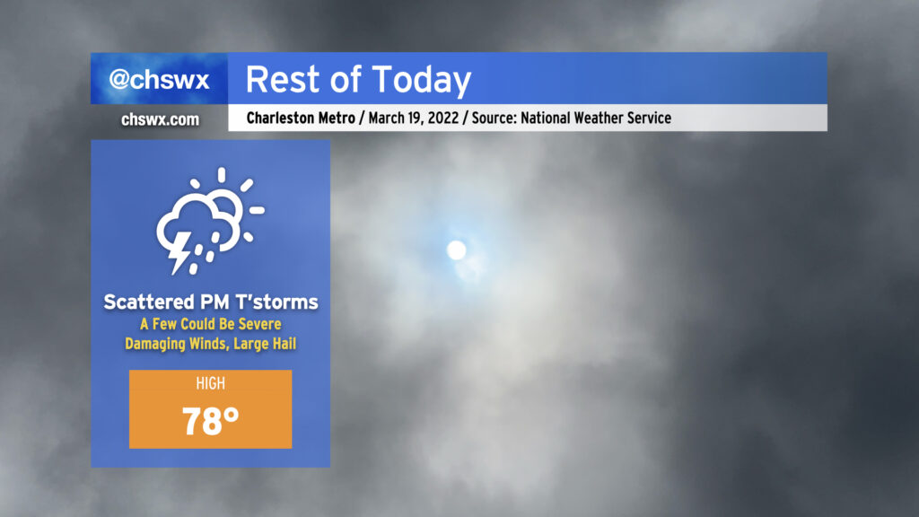
High temperatures across the Charleston metro should top out in the mid-to-upper 70s this afternoon before the cold front gets closer to the area. It’s this surface feature, currently moving across Georgia and into upstate South Carolina, which should provide the needed lift to allow for scattered thunderstorm development this afternoon. Wind shear and instability will not be lacking, and with some capping in place limiting more widespread development to start, storms could initially start off as supercells, increasing the severe weather threat. The strongest storms will be capable of damaging straight-line wind gusts and large hail. A tornado can’t be ruled out, particularly where storms interact with the seabreeze, which is forecast to be near the coast for much of the day. Given strong SW winds keeping the seabreeze pinned to the coast, it is unlikely that cooler waters will have a significant impact on storm strength.
Given the initially isolated nature of these thunderstorms and the timing of the cap breaking, it’s going to be very tough to pinpoint who exactly will see storms and when. General thinking, according to NWS, is that the greatest risk of thunderstorms will generally run between 3-9 PM. Trying to pin down too much more detail may be foolhardy without clairvoyance beyond what the science can provide.
Today’s advice is familiar: Stay close to reliable, redundant weather warning sources, one of which should not be your smartphone. NOAA Weather Radio and broadcast stations are two great ways to fulfill this recommendation. Not everyone will see severe weather today — perhaps, deity of your choice willing, none of us will! — but if it does threaten your location, you’ll want to be prepared to receive that warning and take action on it by having a safe space indoors, away from windows.
I’ll have updates today as needed.