Friday & the weekend: Unsettled, then warming
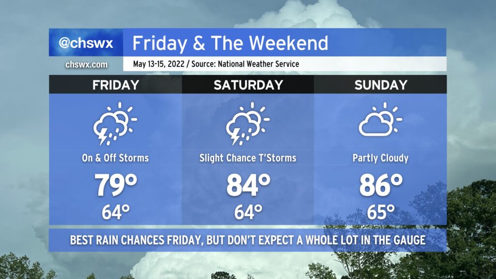
Low pressure, which has brought some generally light showers to the area today, will continue to push southwestward across the area for Friday and the first part of the weekend. The best rain chances arrive tomorrow as the low makes its closest approach, but aside from some pockets of heavier rain, storm totals should generally run around a half-inch to 3/4” at best — certainly not the drought-buster we need. Temperatures will top out a little warmer in the upper 70s to around 80° as winds begin to turn more southerly as the low moves inland.
Scattered showers and a thunderstorm or two will continue to be possible heading into Saturday as the low meanders westward. Southerly flow around the low will continue to keep the heat pump running, though, and highs should top out in the mid-80s in the afternoon after we start in the mid-60s. While a shower or storm can’t be ruled out for Sunday, most should stay dry, and temperatures continue to nudge upward in the afternoon on the higher end of the mid-80s. By next Monday, we should be in the 90s again, so soak up the last of this cool air while you can!