Rest of the work week: Back to the 90s
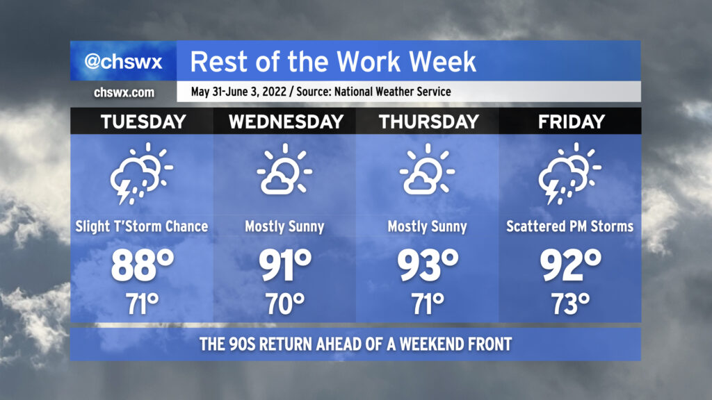
We’re headed back to the 90s as we head back to work and, for the last week this year, school. We’ll see a chance for isolated to scattered showers and thunderstorms along and ahead of the seabreeze on Tuesday, with chances starting near the coast around noon-ish, then migrating inland for the rest of the afternoon. Not everyone sees storms. Expect highs to top out in the upper 80s.
As drier air filters in aloft, we’ll have less cloud cover, less of a shot at afternoon thunderstorms, and thus better opportunities to reach the low 90s each afternoon Wednesday and Thursday. A front will get closer to the area on Friday; compressional heating ahead of the front should send us back to the 90s in the afternoon but with a greater risk of afternoon and evening showers and thunderstorms.
Peeking toward the weekend, it appears the front is going to stall out and hang around. This, combined with an infusion of tropical moisture from the south, could keep the weekend somewhat unsettled. With the front by and high pressure wedging southward, though, we should run a few degrees cooler than we have been as of late (mid-80s as opposed to low 90s). We’ll keep a close eye on this as time goes on for fine-tuning.
In any event — stay cool and keep on watering for at least the next few days as moderate drought continues across the Lowcountry.