Another hot one Thursday
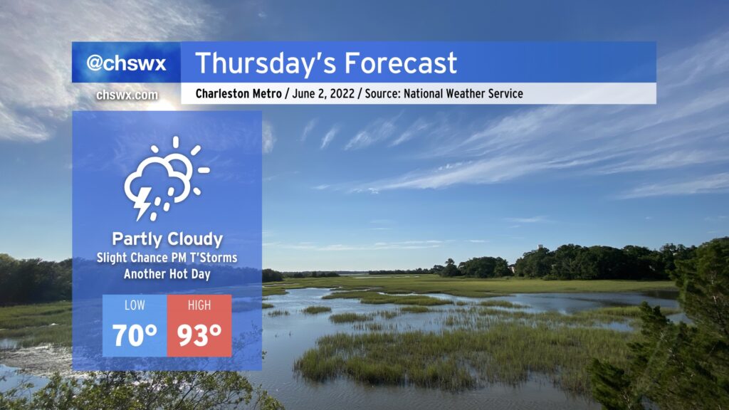
Another hot day is in store for Thursday as highs once again soar into the 90s under partly cloudy skies. Add humidity in, and heat indices could reach 96-97°. There’s a slight chance of a popup thunderstorm or two tomorrow, but the vast majority of us once again look to remain rain-free. If storms do fire, they could produce some gusty winds, heavy rain, and cloud-to-ground lightning, so be ready to move indoors if you’ve got outdoor plans tomorrow afternoon.
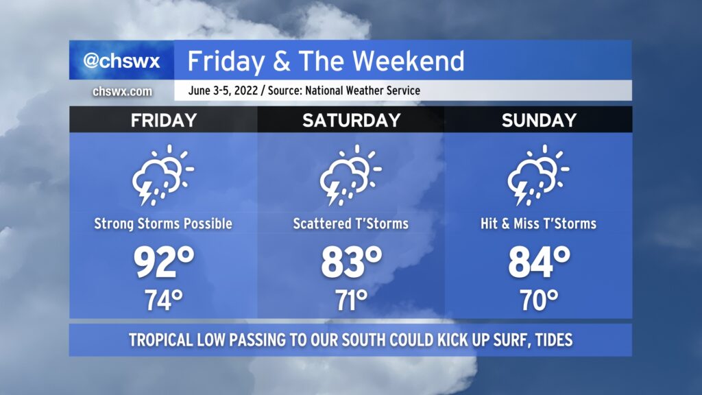
We’ve got one more hot day on Friday ahead of a cold front sagging southward into the area. As the front draws closer, we’ll see an increase in shower and thunderstorm coverage in the afternoon, and a few of these storms could be on the strong to severe side with strong, gusty winds and perhaps some hail. The front will sag south of us and stall out, bringing in some cooler air but also keeping rain and thunderstorm chances in the cards for Saturday. Rain chances diminish somewhat for Sunday, but a storm or two will still be possible. Temperatures will fall back to the mid-80s each afternoon this weekend, which will feel a lot better than where we’ve been the past couple days.
Of note: A tropical low of some sort is expected to develop and track across South Florida later this week. Track models agree that the storm will stay well south of the area, limiting impacts to marine concerns, including rough surf, a high risk of rip currents, and the potential for some coastal flooding at times of high tide getting into Sunday. If this storm is classified as a tropical cyclone and reaches Tropical Storm strength, it will be named Alex.
We’ll continue to keep eyes on the storm threat for Friday and the weekend especially for our friends at Spoleto, with outdoor performances expected Friday and Saturday night. For now, though, there’s no reason to cancel any of those plans — just keep an eye on forecast updates.