Friday & the weekend: Strong storms possible, then a little less humidity
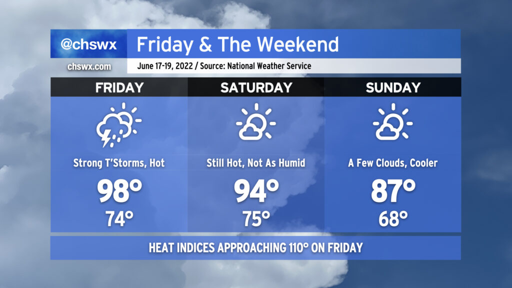
We have another potentially boy-band-hot (98°) day on tap for Friday as temperatures soar ahead of a cold front. Expect heat indices to once again approach 110°, with a heat advisory a near-certainty as a result. Said heat and humidity will translate to plenty of thunderstorm fuel for potential strong to severe thunderstorms in the evening hours ahead of the front. There’s still model disagreement about exactly when and where thunderstorms will fire, but if and when they do, a few will be capable of damaging wind gusts. You’ll want the weather radio nearby tomorrow evening, especially if you are out and about.
The front gets through late Friday into early Saturday, shutting off rain chances and even helping to dehumidify us a touch. Saturday will still be hot, with air temperatures reaching the mid-90s, but dewpoints in the upper 60s as opposed to the mid-70s will keep heat indices generally below 100°. Sunday looks even better — honestly a pretty fantastic day to get outdoors, particularly in mid-June — with a punch of cooler and drier air keeping air temperatures to the mid-80s for much of the area. The respite will be short-lived, though, as temperatures soar once again by the middle of next week, possibly flirting with 100° on Wednesday.