Thursday: Not quite as hot, but the respite is brief
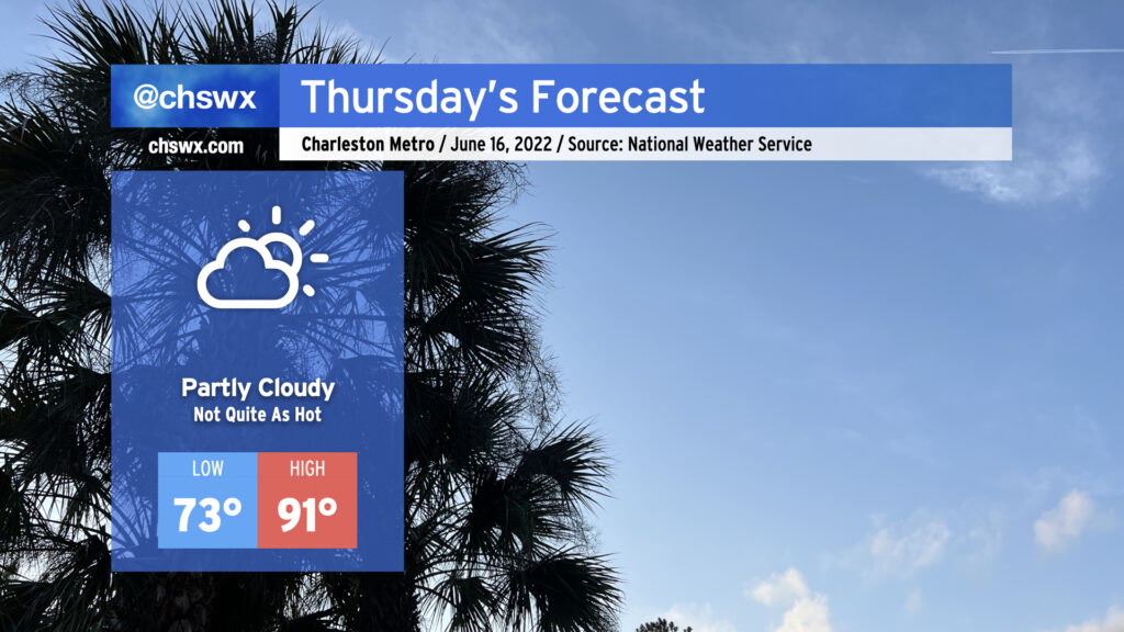
Thursday will run a little cooler — 91° with a heat index of 94° certainly qualifies — as onshore flow behind a backdoor cold front gives us a little break before the heat picks back up on Friday. With the slightly cooler weather comes a somewhat more stable atmosphere, which will keep the risk for afternoon showers and thunderstorms to a bare minimum. All in all, should be a fairly decent day for an outdoor dinner. (Might still be a bit much for eating lunch outside, though.)
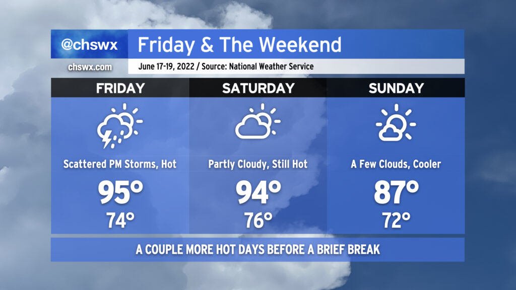
As mentioned, the heat will build back for Friday and again on Saturday. We see a bit of a better shot at showers and thunderstorms Friday afternoon as a cold front approaches the area, with a couple storms potentially on the strong side with damaging wind gusts. We stay hot for Saturday, but the cold front will get through later in the day, yielding a rather pleasant (comparatively) Sunday with highs only topping out in the upper 80s and a few clouds amidst a lot of sunshine. Not a bad beach day, all things considered — just make sure to slather on that SPF. Savor it — the heat looks to rebuild big-time as we get to next week. (I saw 100° next Wednesday in the NWS forecast. 🥵)
Coastal flooding will remain a concern with each evening high tide through Saturday and maybe even Sunday. Moderate flooding will be possible again on Thursday night, with minor flooding the more likely course Friday-Sunday as we close out this set of king tides.