Wednesday: Heat indices 105-107°, then some storms
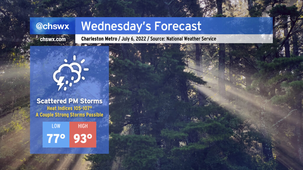
Wednesday will be another quite hot July day ahead of the usual round of scattered afternoon thunderstorms. After a very muggy start — lows in the upper 70s inland, probably not getting below 80° downtown and at the beaches — expect air temperatures to top out in the low-to-mid-90s across the area. Mix in dewpoints running in the mid-to-upper-70s and that’ll yield heat indices approaching 107° in the peak of the afternoon. You’ll definitely want to be taking frequent breaks and getting plenty of water if you’ll be outside for an extended period tomorrow. (Note that Heat Advisory criteria for July onward is heat indices at or above 110° for more than two hours, so while these heat indices would have garnered an advisory last month, they will not in this case.)
Showers and thunderstorms should once again develop along and ahead of the seabreeze in the afternoon. The atmosphere will be primed for a strong storm or two, with plenty of available energy for storms to tap into once the capping inversion erodes. Damaging wind gusts and maybe even some hail will be possible in the strongest storms, while all storms will be capable of locally heavy rain and frequent lightning. Not everyone will see severe weather, much less a storm at all — coverage looks scattered at best. But if you do, it could be a good one.
Two things to watch
We’ll want to keep an eye on the land breeze in the morning as some of the short-term high-resolution guidance wants to develop a line of showers and thunderstorms just offshore. Given the light wind fields in place, it wouldn’t shock me if we had a few more waterspout reports tomorrow morning. Stay alert especially if your morning plans involve the beaches.
Secondly, there continues to be good model support for a thunderstorm complex to move out of the Ohio Valley toward the Carolinas during the day Wednesday. We’ll want to keep an eye on how this evolves as there’s a non-zero chance it could make a run at our neck of the woods later Wednesday night, though the consensus right now is that much of it misses us to the north.