Friday & the weekend: Turning more unsettled
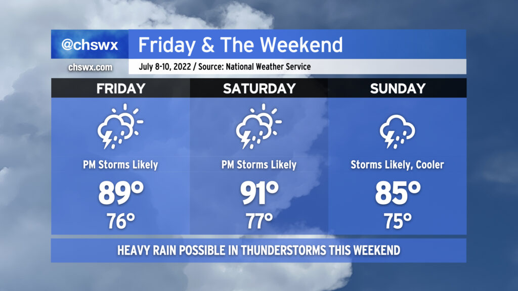
As ridging aloft breaks down and retrogrades westward, our weather will turn much more unsettled heading into Friday and the weekend. Storms will be likely especially each afternoon and evening, with Sunday possibly looking particularly stormy with a surface front pushing through the area. Heavy rain will once again be quite possible, as precipitable water values remain 2″+ throughout the period — a lot of water to wring out of the atmospheric column, to be sure. Excessive rainfall will be possible in the strongest storms. There will also continue to be a risk for sporadic severe weather in the form of damaging straight-line wind gusts.
Temperatures on Friday and Saturday will still head right into the upper 80s to low 90s. With a stiflingly humid airmass continuing in place, heat indices will once again soar well into the 100s, with max heat indices around 105° on Friday and 108° on Saturday. Showers and thunderstorms will keep air temperatures from getting too much further out of hand, thankfully, but this is plenty of heat as is. Remember to take frequent breaks in the shade if you’re outside during these hot periods.
The good news is that all this rain continues to erode the drought — much of the Tri-County area was in moderate drought on last week’s Drought Monitor, but today’s downgrades the area (particularly around the Charleston metro) to Abnormally Dry. The airport is still running about 4.62″ behind normal for this point in the year, but we should hopefully continue to dent that deficit this weekend.