Rest of the work week: Warm, occasionally unsettled, with higher rain chances Friday
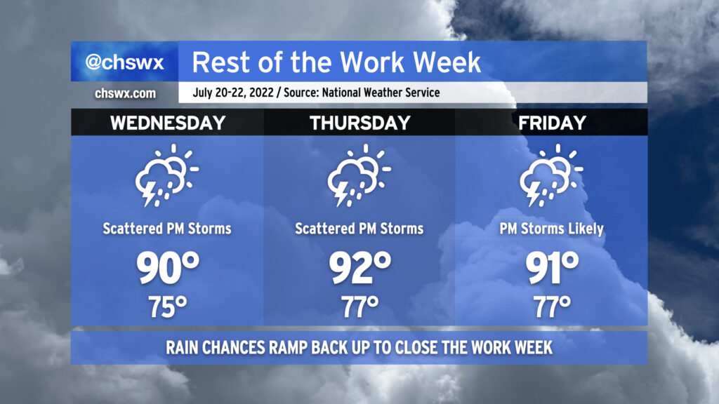
Our warm and occasionally stormy pattern stays in place of the rest of the work week as we remain under the influence of a broad trough aloft. Wednesday will yield another stormy afternoon with a low-end severe weather risk as a disturbance in the mid-levels moves across the Carolinas; if a storm turns severe, damaging wind gusts would be the main issue. Otherwise, it’s another hot and humid day — highs top out around 90° in the afternoon with heat indices once again peaking around 100-102° before storms develop and disrupt the temperature curve.
Thursday should run a little quieter with a little less mid-level energy in play, but we’ll still see the usual spate of isolated afternoon showers and thunderstorms along and ahead of the seabreeze. Temperatures will run a little warmer Thursday, with air temperatures in the low 90s and associated humidity yielding heat indices running around 105° in the afternoon. A cold front will sink southward toward the Carolinas on Friday; this will make showers and thunderstorms in the late afternoon and evening hours a little more likely. Temperatures on Friday continue in the low 90s with heat indices in the low to mid-100s.
Rain chances look to taper off as we get into the weekend, with scattered storms possible Saturday and more isolated storm coverage than we’ve seen in a little while expected on Sunday. It’ll stay muggy with lows in the mid-70s and highs in the low 90s each day.