Friday & the weekend: Still steamy and stormy
More steamy and occasionally stormy weather is in store for the weekend as a cold front moves close by and stalls out. It won’t be a total rainout, but backup plans for weekend activities are not a bad idea.
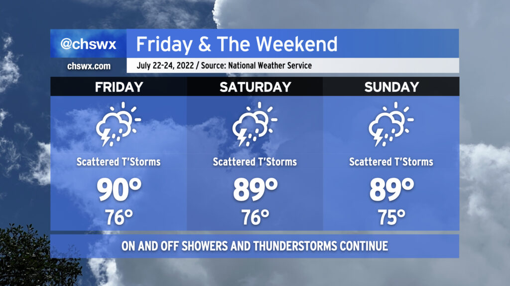
Friday should start out rain-free in the metro area, but it’ll still be quite warm as we start In the mid-to-upper 70s, warmer toward the coast. Temperatures should rise to around 90° by early afternoon before thunderstorms develop. Humidity will make it feel closer to 103°. Once again, there’s a risk for very heavy rain with these storms, and given the soaking we’ve had recently, flooding is once again a concern.
And so it will go heading into the weekend, as well, with the stalled front acting as a focal point for additional showers and thunderstorms to develop around the area. Temperatures will, before thunderstorms mess things up, top out around 90° each day, with heat indices reaching into the 100s. Heavy rain and flooding remain a threat; a wet microburst with damaging wind gusts can’t be ruled out in the strongest storms, either.
There is change coming, though. We’ll see high pressure begin to reassert itself both at the surface and aloft. This will help to suppress the more widespread thunderstorm activity we’ve seen for the balance of this month as we head into next week, though it won’t eliminate it completely as an isolated shower or storm will be possible along and ahead of the seabreeze. Temperatures, though, will continue to generally run in the low 90s each afternoon, with heat indices continuing to run in the low 100s. And so, summer rolls on. (At least the tropics remain quiet!)