Rest of the work week: Getting hot in here
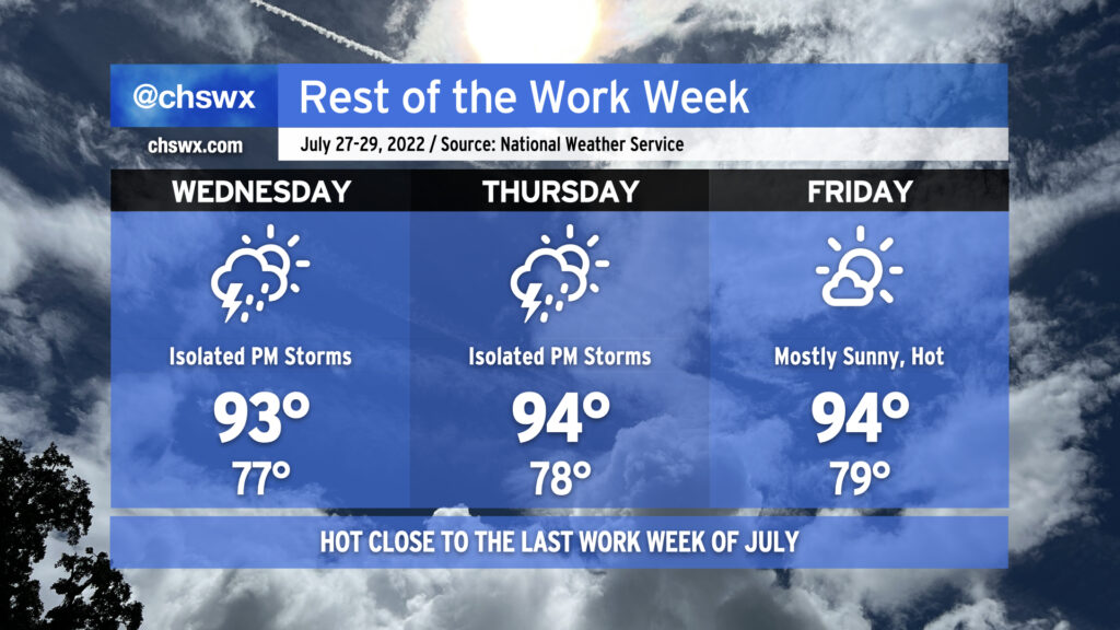
We’ll be closing out the last work week of July with a good bit of heat as high pressure dominates the weather pattern. Air temperatures will run into the mid-90s each afternoon, while humidity on top will make it feel well into the mid-100s. While heat indices will not reach the post-July 1 heat advisory criteria of 110°, it’ll still be enough to elevate the risk of heat-related illness. Make sure you’re getting plenty of fluids and taking plenty of shady breaks during the heat of the afternoon if you must be outdoors. Low temperatures will run quite warm as well, only bottoming out in the upper 70s away from the coast. Downtown and coastal communities may not see lows dip below 80° for several days. This lack of any real cooling off can add to cumulative heat stress over time.
The aforementioned high pressure will keep afternoon showers and thunderstorms to a minimum, with only isolated coverage expected along and ahead of the seabreeze on Wednesday and Thursday, with unmentionably low rain chances on Friday. It’s hard to stay totally rain-free this time of year, but don’t expect much out of storms over the next few days.