Friday & the weekend: Stormy end to the work week, but a humidity reprieve awaits
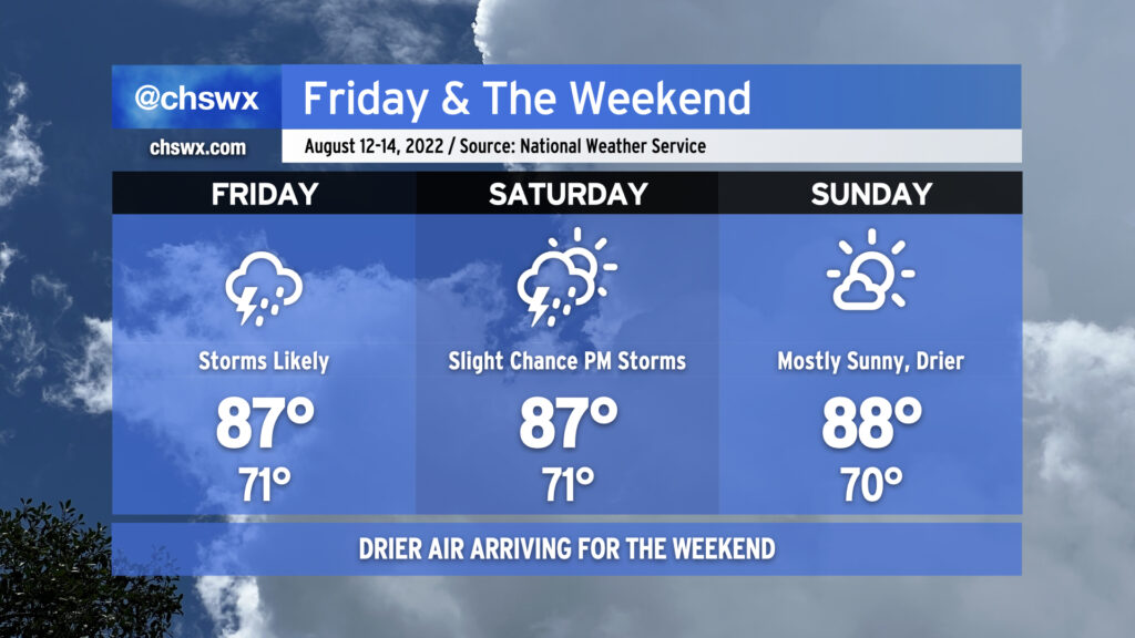
A cold front will push southward across the area on Friday, likely bringing with it showers and storms especially in the afternoon and evening hours. The convection-allowing models generally agree on some sort of linear storm organization pushing southward into the area tomorrow evening; the greater question is whether storms will fire ahead of it as well. I’d be prepared for periods of unsettled weather throughout the day, and be ready for another commute impacted by showers and thunderstorms. A severe storm or two can’t be totally ruled out, but the main concern will be heavy rainfall and frequent lightning. Cloud cover and rain showers should help keep highs suppressed to the mid-and-upper 80s.
The front will move south of the area and stall out on Saturday, switching winds around to the northeast and beginning to usher in some cooler and drier air the likes of which we haven’t seen since late June. Dewpoints will fall into the mid-60s and cloud cover will scour out somewhat. However, there’s still a slight chance for showers and thunderstorms in the afternoon hours as a wave of low pressure develops along the front. If that wave develops nearby (as tonight’s NAM 3km suggests), it could spread some moisture ashore. That aside, Saturday should actually feel really terrific, especially further inland. Same for Sunday, where partly cloudy skies and mid-60s dewpoints will persist, making for another comfortably warm day across the Lowcountry.
Onshore winds and the recent full moon at perigee could contribute to water levels approaching minor flood stage with the Saturday evening high tide. So far, I’m not expecting any major tidal flooding issues, but it always bears watching with northeasterly wind directions near a full moon.